Private Snaefellsnes Peninsula Tour
Active
12h - 13h
For a full refund, cancel at least 24 hours before the scheduled departure time.
Instant confirmation
Mobile or paper ticket accepted
About this experience
Experience the energy of the mystical "Iceland in miniature" Snæfellsnes peninsula and make the most of your day by choosing from various bookable activities to add.
Available options
1-3 passengers
1-3 passengers<br/>Pickup included
4-7 passengers
4-7 passengers<br/>Pickup included
What's included
Private transportation
Knowledgeable & experienced English speaking driver-guide
Pickup & drop-off within the Reykjavik Capital Area
Air-conditioned vehicle
Parking Fees
Detailed itinerary
1
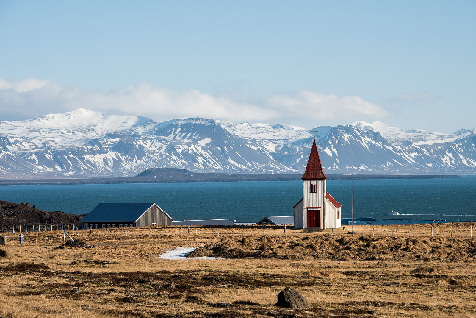
Vatnaleið is a mountain pass between the north and south coasts of the Snæfellsnes peninsula. It first opened in 2001, superseding the gravel road over the Kerlingaskarð pass. A rest stop by the river Fossá on this route has tables and chairs made from basalt rocks which were found during the construction of Vatnaleið. From there you have a vast view over the lake Selvallavatn and the surrounding lava field and mountain rows. A short walk up the Fossá river takes you to a two-ledged waterfall called Selvallafoss - also known as Sheep's Waterfall due to sheep sometimes resting on a ledge behind it. Further down this route is the 80 m (262 ft) high and 211 m (629 ft) wide scoria crater Gráakúla which formed over 4,000 years ago. Being red, it is also covered with grey moss which gives its name Gráakúla. It is the second-largest crater in a row of four scoria craters that erupted over 4,000 years ago, with lava flowing in the NW direction creating the rugged Berkserkjahraun Aa lava field.
2
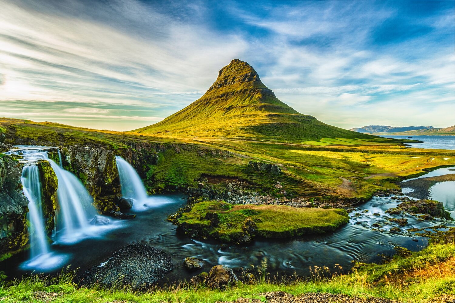
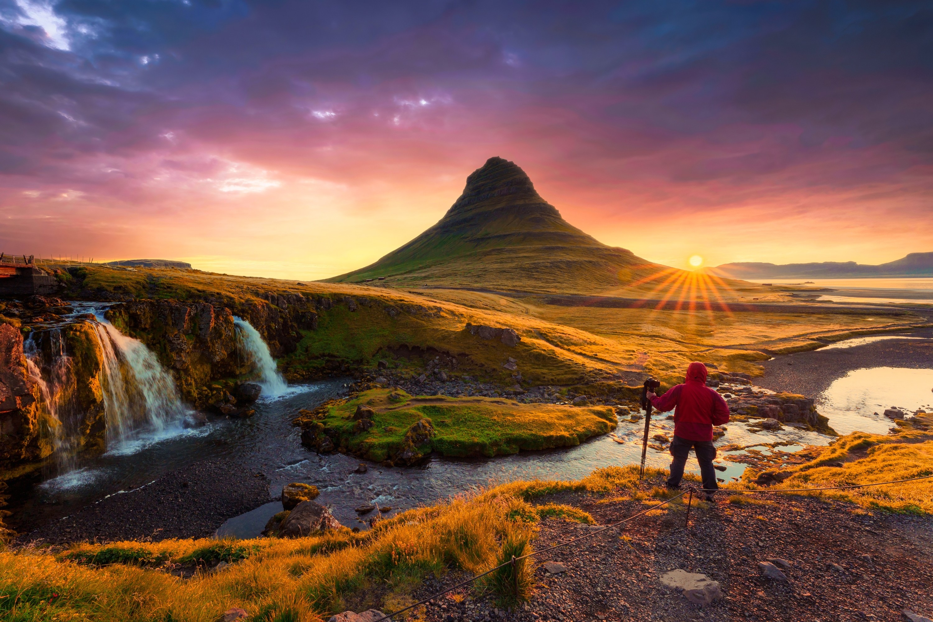
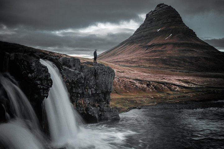
The town of Grundarfjörður has a population of a little under 900 people. It is one of the five communities of Snæfellsnes that in 2020 received a Platinum Certification by EarthCheck for environmental destination standards, confirming the Snæfellsnes region is an environmentally conscious community. Hovering over this fishing town is the 463 m (1,519 ft) mountain Kirkjufell (e. Church Mountain) known by fans of Game of Thrones as the Arrowhead Mountain in seasons 6 and 7, making it the main attraction and landmark of Grundarfjörður. Kirkjufell has been referred to as the most beautiful mountain in Iceland and is believed to be the most photographed mountain of them all.
Kirkjufell gives its name to the small Kirkjufellsfoss waterfall, which is often photographed as the foreground of Kirkjufell. It runs down the river Kirkjufellsá, creating three waterfalls all bearing the same name.
3
The little fishing village Ólafsvík is an old market town and one of the larger trading posts of the 17th and 18th centuries in Iceland, being a commercial vessel between Denmark and Iceland. It was the first town in Iceland to receive commercial rights from the Kingdom of Denmark. In the town center stands an old warehouse constructed in 1844, which now serves as a museum and an information center. Called Pakkhúsið, it is among the few last standing business premises built in the 19th century and is a monument representing the town's past and history. We highly recommend making a stop for lunch at our favorite restaurant in Ólafsvík to try their delicious fish courses with freshly caught fish (they also have great vegan options).
A short drive out of Ólafsvík is the beautiful 10 m (33 ft) high Svöðufoss waterfall, falling off a basalt columned cliff. From the parking lot is a short walk to a resting area with a viewing platform to admire Svöðufoss.
4
Skarðsvík bay has a beautiful secluded golden sand beach surrounded by deep black fractured basalt columns, and the depth combined with the bright clean ocean makes it aquamarine-colored. Icelanders are more used to black sand beaches all around Iceland, so this beach makes for a change. Though the waves are not as strong and forceful as the ones by the Reynisfjara black sand beach on the South Coast, we still advise to not go too close to the waterline. A wooden path from the parking lot makes a short walk to the golden Skarðsvík beach.
5
Öndverðarnes cape is the westernmost point of the Snæfellsnes peninsula which used to be an old fishing station from the 13th century into the 20th, with a chapel on-site and a lot of huts for the fishermen. The small and orange-colored Öndverðarnesviti standing 5 m (16 ft) tall, was built in 1973 but before was another lighthouse built in 1909 which was the first lighthouse on the Snæfellsnes peninsula. South of the Öndverðarnes lighthouse is another orange lighthouse built in 1939 by a cliff that used to have a stone bridge attached to the sea rock Skálasnagi, creating an arch before that bridge collapsed in 1973. What is unique about this 12 m (39 ft) high lighthouse is it bears two names; Svörtuloftaviti when you are out at sea, and Skálasnagaviti on land. Another lighthouse used to stand there, built in 1914, but it collapsed after the ocean waves had eroded the cliff. The rugged cliffside along the coastline between these two lighthouses is called Svörtuloft.
6
A short walk through a lava field down Nautastígur (e. Bulls' Path) takes you to the black beach Djúpalónssandur (e. Sand of Djúpalón). It's not a beach of sand but black smooth pebbles referred to as Djúpalónsperlur (e. Pearls of Djúpalón). These pebbles are protected so you are only to admire them and not take any away with you. Behind Nautastígur are do small loons called Djúpalón (e. Deep Lagoon) and Neðra-Lón (e. Lower Lagoon), which the beach derives its name from. By them are four lifting stones in different sizes called Aflraunasteinar (e. Test of Strenght Stones), used to measure the strength of fishermen who wanted to earn their spot on fishing boats. These lifting stones are: Amlóði 23 kg / 51 lbs (e. Weakling), Hálfdrættingur 54 kg / 119 lbs (e. Half a Man), Hálfsterkur 100 kg / 220 lbs (e. Half Strong), Fullsterkur 154 kg / 339 lbs (e. Fully Strong). If a fisherman could lift Hálfdrættingur, he was accepted on board.
7
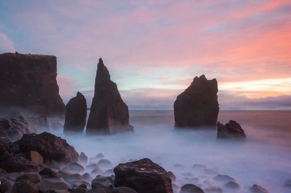
Two rock pinnacles stand tall just out of the shore called Lóndrangar (e. Lagoon's Pillars), 61 m (200 ft) and 75 m (264 ft) high. One of the pinnacles is believed to be an elves' church and the other to be their library. Due to the cliffs by the shore being so dangerous, an observation platform was constructed by Þúfubjarg and Svalþúfa for a view of Lóndrangar in distance. Þúfubjarg is a cliff that is home to various sea birds nesting, standing beneath the palagonite headland Svalþúfa. It is forbidden to mow the grass on Svalþúfa as it is believed to be inhabited by elves.
From the observation platform, you see over to the reef Malarrif where the 24 m (74 ft) high lighthouse Malarrifsviti stands tall. Built in 1946, it is a white cylindrical tower with a red lantern house on top. For centuries, Malarrif was a fishery until 1900 and then a farm till 1997 which now is abandoned.
8
Hellnar was among the largest fishing station on the Snæfellsnes peninsula, dating back to 1560. Having about 200 residents living there in 1703, with 38 buildings functioning as farms and lodgings and structures related to the fishery, times have changed since then. Now a lot fewer people live there. A café is by Hellnafjara and is popular for the location and view it offers from its patio over beautiful rock formations by the sea. Locals often walk a 2.5 km (1.55 mi) route by the coast over Hellnahraun to Arnarstapi, starting from this little café in Hellnar. In front of the café by the shore is the protruding boulder Valasnös with an opening and a cave called Baðstofa, very unique for the coloration inside that forms due to the tides and different lighting and its walls being made of schist rocks which is a type of rocks that look like flakes or scales. Schists were sometimes used as tiles on the roofs of turf houses in some parts of Iceland.
9
Arnarstapi is a small fishing village with strange rock formations along its coastline and cliffs filled with nesting sea birds. First, you're greeted by the huge statue of Bárður Snæfellsás, the aforementioned protector of Snæfellsnes. Then a walking trail takes you along the coastline for admiring various lava and basalt formations. The rock arch Gatklettur extends from the cliffs with a big hole through, and further along, are three holes in the ground with the ocean coming in and basalt cliffed walls with sea birds nesting on some days the strong ocean waves splash up into the air from these ravines.
10
The very small village of Búðir is a popular destination for visitors. It is believed to have been the landing of fishing and commercial ships since Iceland was settled, functioning mainly as the commercial and trading post of Snæfellsnes and the west coast region during the Danish trade monopoly. Búðahraun has been a protected area since 1977, originating from the eruption of Búðaklettur, a 88 m (289 ft) high scoria crater standing in the middle of the lava field, believed to have erupted 5,000-8,000 years ago. This pitch-black lava field is unique for the vegetation growing there. The eastern part of this lava field is pahoehoe lava which contains a lot of caves, fissures, and holes and some of them are visible while the others are covered in moss and vegetation. One of the most photographed churches of Iceland is the black wooden Búðakirkja, along with its graveyard.
11
Walking down a path is Ytri-Tunga, a beautiful golden sand beach most known for seal watching. Seals reside there all year, though you are not as likely to spot them during wintertime since the best time is in summer after they pup. The two species residing there are the harbor seal (lat. Phoca vitulina), also known as the common seal, and the grey seal (lat. Halichoerus grypus). The harbor seal is the more common seal specie in Iceland and they are genetically distinct from other harbor seals in the NE Atlantic Ocean. The grey seal is considerably larger than the harbor seal, with a longer flatter head.
Seals used to be vital to Icelanders for survival due to their meat, fat, and waterproof hides but hunting seals is now prohibited in Icelandic territory.
Please remember to not approach the seals and keep a distance of at least 50 m (164 ft) from them, both for you and the seals. They can become dangerous when frightened so keep any noise respectfully low.
What's not included
Food & drinks (your private driver-guide can recommend stops for refreshments during the tour)
Gratuities
Entry or admission fees to activities outside of the itinerary
Available languages
Guide guide
EN
Important information
Service animals allowed
Public transportation options are available nearby
Suitable for all physical fitness levels
About Reykjavik
Reykjavik is the world's northernmost capital city, known for its vibrant cultural scene, stunning natural surroundings, and unique Icelandic charm. It offers a blend of modern amenities and ancient geothermal wonders, making it a must-visit destination for travelers seeking both adventure and relaxation.
Top Attractions
Hallgrímskirkja
This iconic church is a landmark of Reykjavik, known for its distinctive architecture and towering spire. It offers panoramic views of the city from its tower.
Architecture/Religious
1-2 hours
Moderate (ISK 1000 for the tower)
Harpa Concert Hall
A stunning modern concert hall with a glass facade that reflects the surrounding landscape. It hosts a variety of performances and events.
Architecture/Entertainment
1-2 hours
Free to enter, performance tickets vary
Blue Lagoon
A geothermal spa known for its milky-blue waters rich in minerals. It's a popular spot for relaxation and rejuvenation.
Nature/Relaxation
Half a day
Expensive (ISK 49,900 and up)
Reykjavik Art Museum
A museum showcasing contemporary Icelandic and international art. It's housed in a striking building with a glass facade.
Museum
1-2 hours
Moderate (ISK 1400)
Perlan Museum
A unique museum located in a glass dome that offers a variety of exhibits, including a glacier exhibit and a planetarium.
Museum
2-3 hours
Moderate to Expensive (ISK 3,990 and up)
Must-Try Local Dishes
Plokkfiskur
A traditional Icelandic fish stew made with mashed potatoes, white fish, onions, and béchamel sauce.
Main Course
Contains fish and dairy
Hákarl
Fermented shark, a traditional Icelandic delicacy known for its strong smell and taste.
Snack
Contains fish
Skyr
A thick, creamy Icelandic yogurt-like dairy product, often served with berries or cream.
Dessert
Contains dairy
Rúgbrauð
A dense, dark rye bread traditionally baked underground using geothermal heat.
Bread
Vegan
Popular Activities
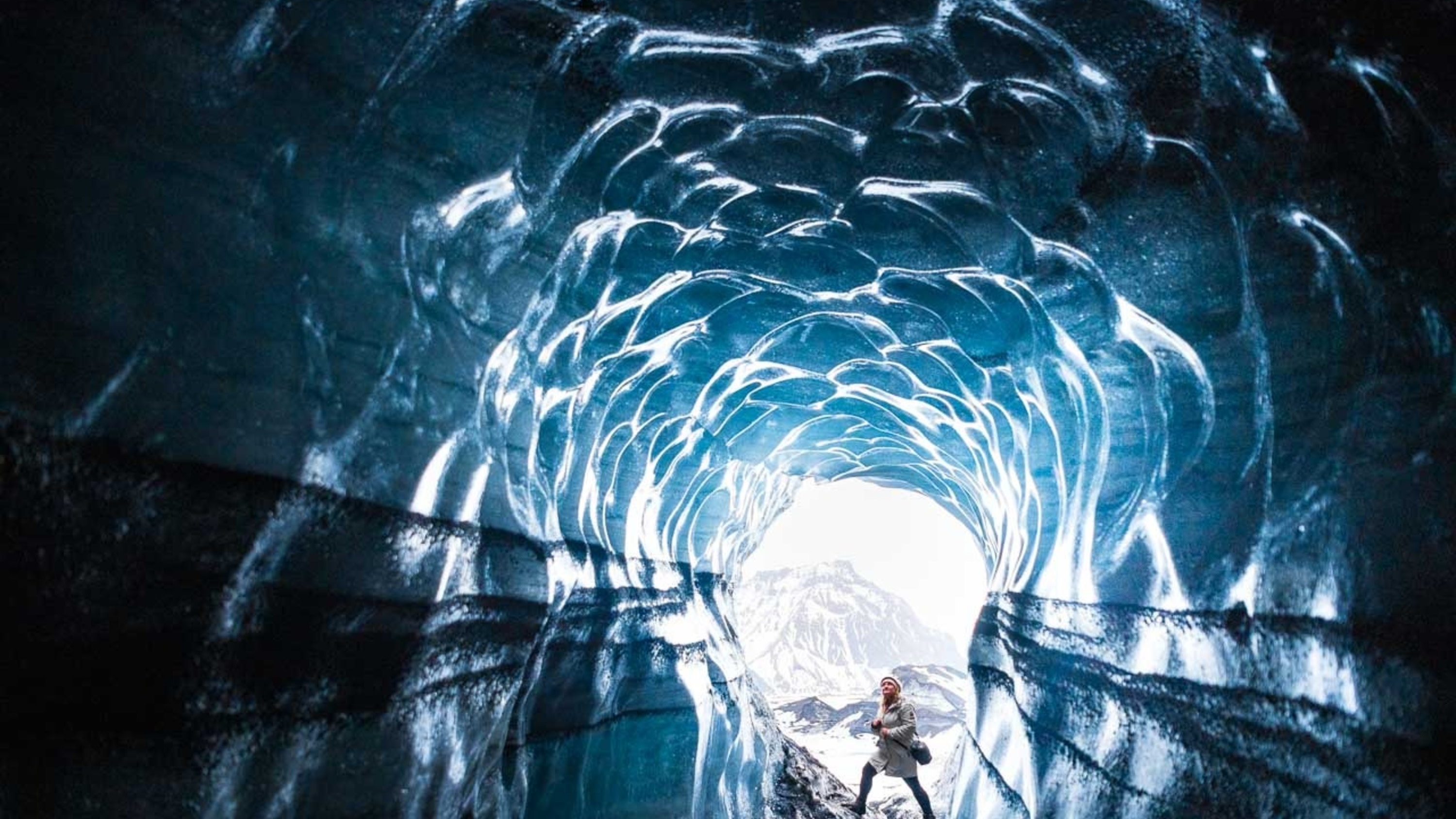
Glacier hiking and ice climbing
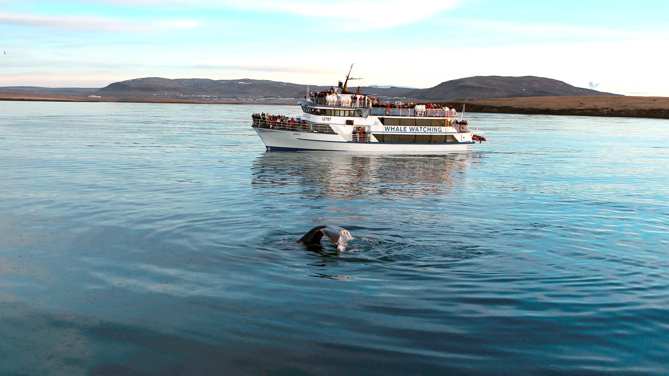
Whale watching
Snowmobiling on a glacier
Caving and lava tunnel exploration
Visiting geothermal spas like the Blue Lagoon or Sky Lagoon
Enjoying a traditional Icelandic massage or spa treatment
Taking a leisurely walk around Tjörnin Lake in Reykjavik
Visiting museums and galleries
Best Time to Visit
June to August
This is the warmest time of the year with long daylight hours, making it ideal for outdoor activities and sightseeing. The city is lively with numerous festivals and events.
8°C to 13°C (46°F to 55°F)
46°F to 55°F
Practical Information
Language
- Official: Icelandic
- Widely spoken: English, Danish, German
- English: Widely spoken
Currency
Icelandic Króna (ISK)
Time Zone
GMT+0
Electricity
230VV, 50HzHz
Safety Information
Overall Safety Rating: Generally safe
Iceland is a very safe country with low crime rates. However, it's always important to be aware of your surroundings and take precautions to ensure your safety.
Important Precautions:
- • Keep your valuables secure and be aware of your surroundings, especially in crowded areas
- • Be cautious when using ATMs, and only use ATMs located in secure, well-lit areas
- • Research tour operators and rental companies before booking to ensure they are reputable and legitimate
Getting there
By air
- Keflavík International Airport • 50 km (31 miles) from Reykjavik
By bus
BSÍ Bus Terminal
Getting around
Public transport
The bus system is efficient and affordable, with frequent services and easy-to-use ticketing.
Taxis
Available • Apps: Bustravel, Uber (limited availability)
Rentals
Car, Bike, Scooter
Neighborhoods
Downtown Reykjavik
Hlemmur
Vesturbær
Day trips
Golden Circle
230 km (143 miles) from Reykjavik • Full day
A popular day trip route that includes three of Iceland's most famous attractions: Þingvellir National Park, Geysir Geothermal Area, and Gullfoss Waterfall.
South Coast
150-200 km (93-124 miles) from Reykjavik • Full day or overnight
A scenic drive along Iceland's south coast, offering a variety of attractions, including waterfalls, black sand beaches, and glaciers.
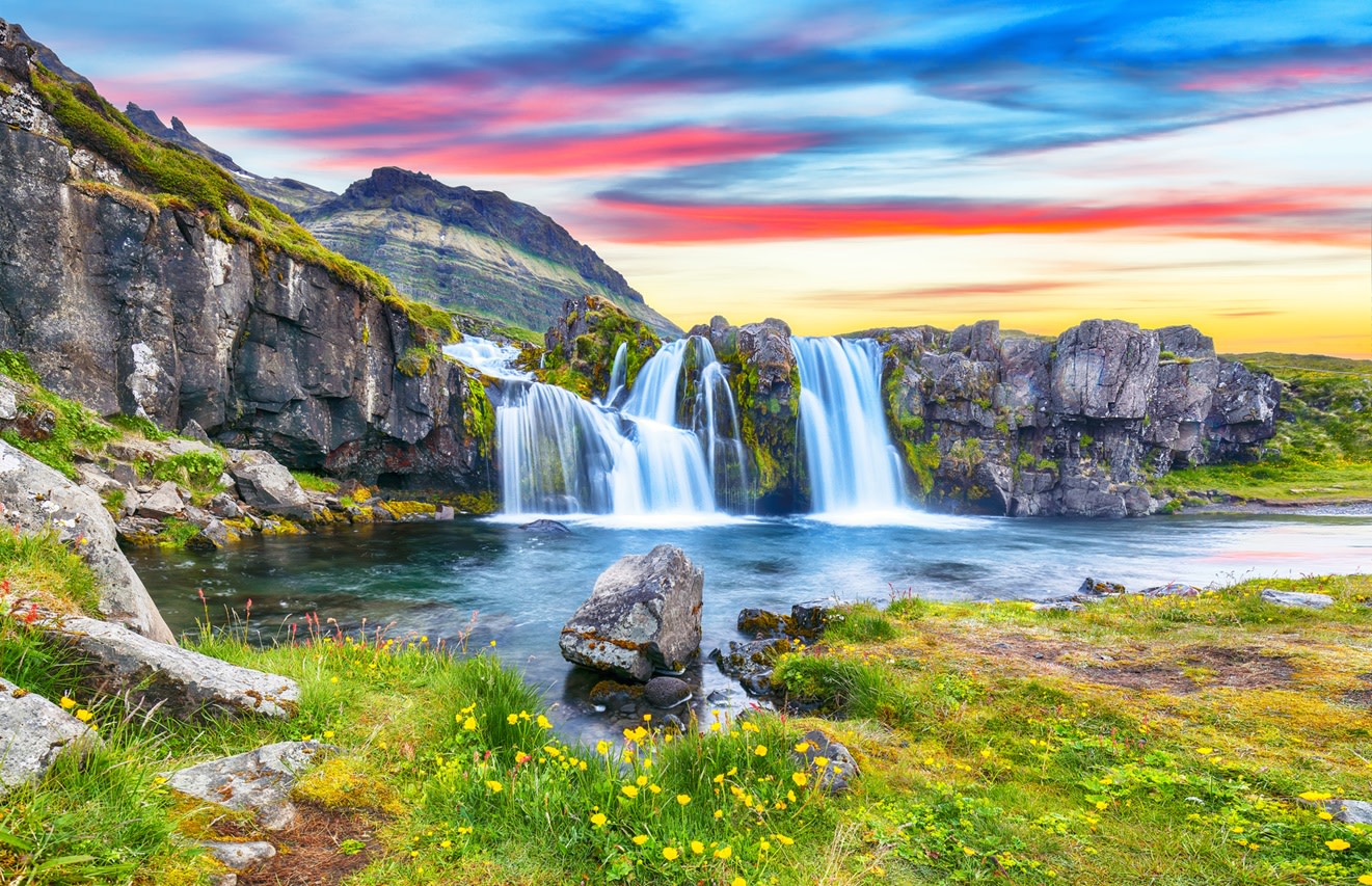
Snæfellsnes Peninsula
240 km (149 miles) from Reykjavik • Full day or overnight
A scenic peninsula known as 'Iceland in Miniature' due to its diverse landscapes, including mountains, glaciers, lava fields, and beaches.
Festivals
Reykjavik Arts Festival • Late May to early June
Iceland Airwaves • Early November
Reykjavik Winter Lights Festival • Late January to early February
Pro tips
- Visit the Blue Lagoon or another geothermal spa for a relaxing and rejuvenating experience
- Explore Reykjavik's street art and murals, which can be found throughout the city
- Take a day trip to the Golden Circle or another nearby attraction for a taste of Iceland's natural wonders
- Try traditional Icelandic food, such as lamb soup, fish stew, and fermented shark
- Visit a local brewery or distillery and sample Icelandic craft beer or spirits
From $25
per person
Price varies by option
Secure booking
Free cancellation available
Instant confirmation