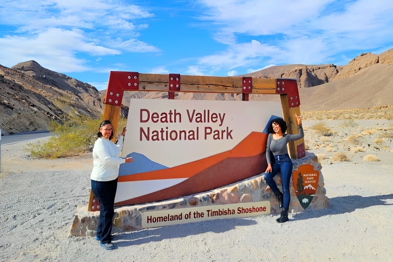
Death Valley National Park Self-Guided Audio Driving Tour
Active
4h - 5h
For a full refund, cancel at least 24 hours before the scheduled departure time.
Instant confirmation
Mobile or paper ticket accepted
About this experience
Experience the harsh beauty of a land like no other: Death Valley. Famed for its record-breaking temperatures, this valley also serves up some sizzling scenery, from sprawling salt flats to rainbow-colored badlands and soaring mountain ranges. This self-guided driving tour shows you the best spots in the park and fills you in on this area’s rich history. Follow in the footsteps of Gold Rush miners and hear their stories as you explore this bizarre, unforgettable valley.
Recommended: purchase one tour per car. Everyone can listen at the same time!
After booking, check your email/text to download the separate Audio Tour Guide App by Action while connected to WiFi or mobile data. Enter the password, download the tour, and enjoy it offline. Follow the audio instructions and route from the designated starting point.
Buy once, use for one year! Ideal for extended visits and return trips over the next 12 months.
Available options
Death Valley National Park Self-Guided Audio Driving Tour
What's included
Easy-to-use app: download Action’s Tour Guide App onto your phone
Great value: purchase per car, not per person. More affordable than bus or guided tours!
Engaging storytelling: Uncover unique tales and thrilling history for a memorable journey!
Perfect narrator: nothing can beat listening to a great voice. Proven with tons of rave reviews!
Offline maps: no signal, no problem! Works perfectly without cellular or wifi.
Comprehensive route and stops: See it all, miss nothing, leave no stone unturned!
Go at your own pace: Start anytime, pause anywhere, enjoy breaks for snacks and photos freely!
Hands-free: audio stories play on their own based on your location. Easy to use!
Detailed itinerary
1
Despite its foreboding name, this valley is one of the most thrilling places in the country. Sure, it’s the hottest place in the world, but you’ll soon see that the heat is worth the hassle!
Note: The tour is over 80+ miles long, with more than 55 audio stories, and takes about 4-5 hours to complete.
Buy once, use for one year! Ideal for extended visits and return trips over the next 12 months.
2
Stop 2
While the famed Gold Rush brought a huge influx of hopefuls to Death Valley, it wasn’t gold which kept the valley on the map. In their frantic search for that prized metal, miners stumbled upon something just as valuable: borax.
3
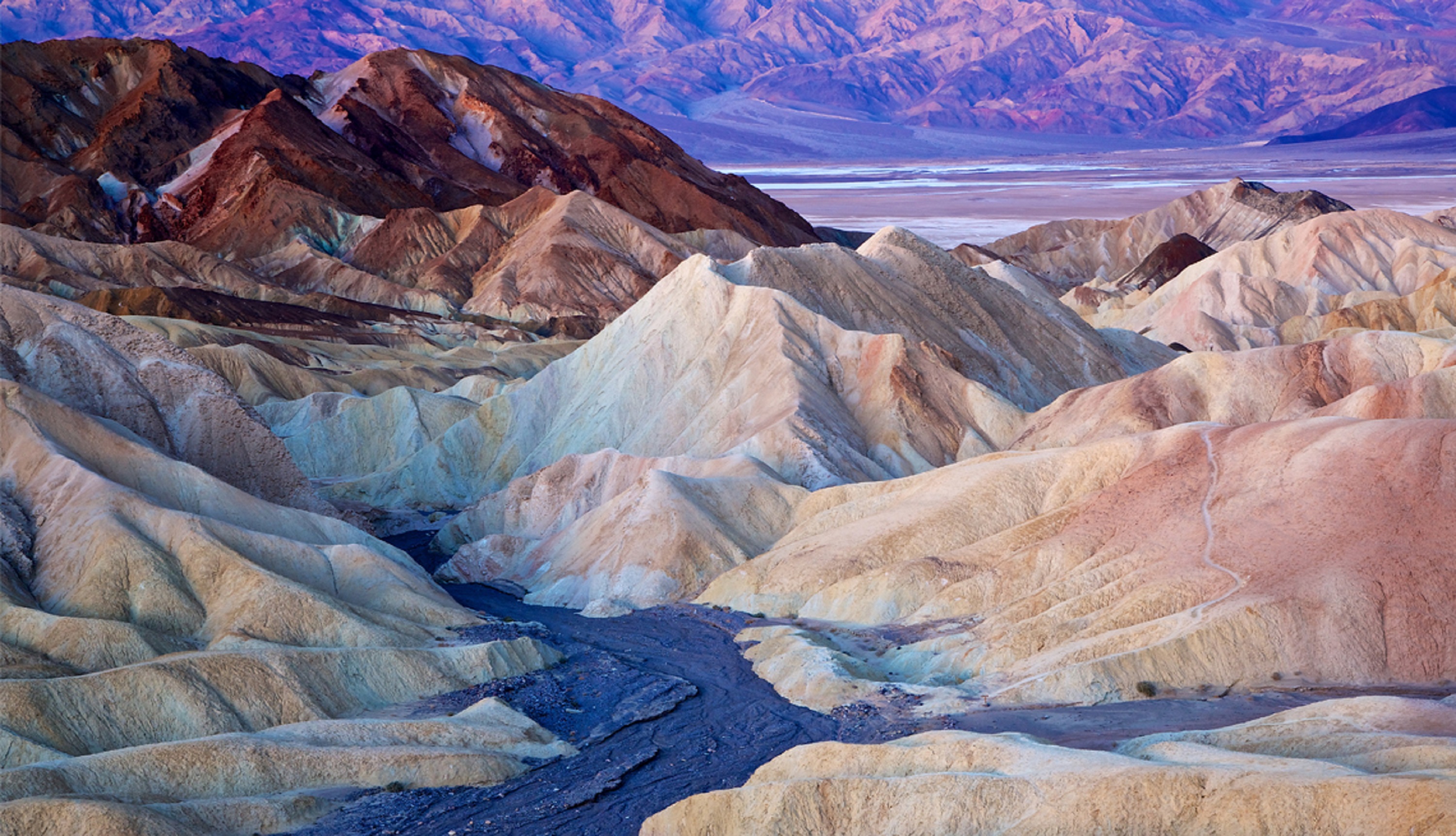
Affording breathtaking views of the undulating salt flats below, Dante's View is a phenomenal place for photography, or simply watching the sun set behind the Panamint Mountains. This vista towers more than 5,000 feet above the Badwater Basin, on the cusp of the Black Mountain Range.
4
Stop 4
Pass by
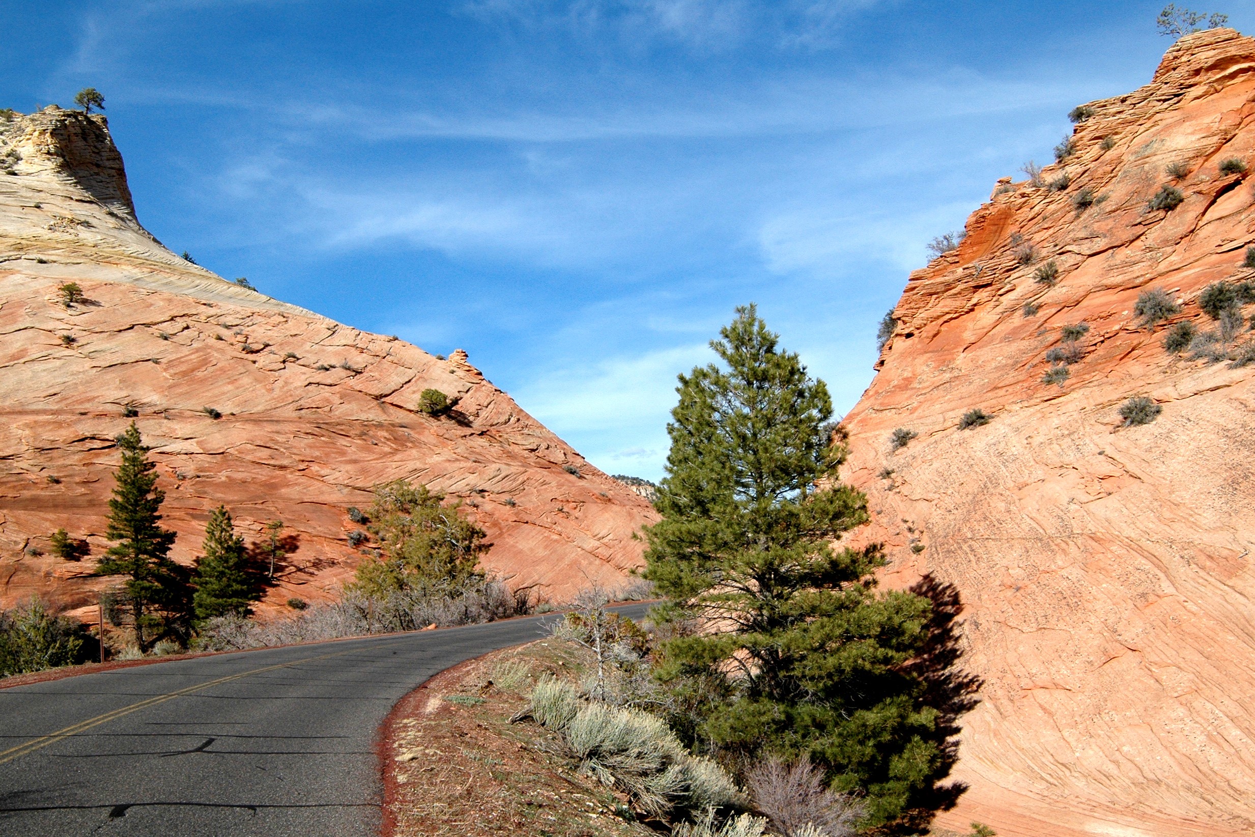
This is Twenty Mule Team Canyon, named for those iconic wagon trains I just mentioned. This winding road offers some truly excellent desert scenery as you weave between saffron colored hills and colorful badlands. If you visit in the early morning or around sunset, you’ll be treated to dazzling colors as the orange sunlight paints the dramatic rock faces.
5
Stop 5
Pass by
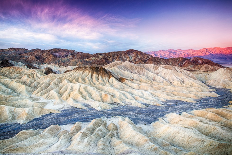
Named for a 19th-century borax baron, who you’ll hear about in a second, Zabriskie Point is easily one of Death Valley’s most iconic locations. From this perch on the Amargosa Mountain range, you can really see how erosion has shaped this valley. Directly below are the badlands. Past those, much lighter in color, you’ll see the dazzling salt flats. All of it is framed by the hulking Panamint Mountains beyond.
6
Here at the Furnace Creek Visitor Center, you’ll find snacks, water, and restrooms, but more importantly…a thermometer! Just outside the entrance is a big digital readout that’ll tell you exactly how hot it is here at one of Death Valley’s lowest points. Make sure to snap a photo standing next to it to shock your friends and family back home.
7
From here, you can access the Golden Canyon trail. This out and back trail is about 3 miles total, and takes around one hour to complete. This popular trail sees many visitors each year, so you’re sure to encounter a few fellow hikers during your trip!
8
Stop 8
That gentle hill off to your right is called Mars Hill. If you think about it, the name makes sense! Much of Death Valley brings to mind the arid, lifeless surface of the planet Mars. The deep ochre stones, strange rock formations and great dusty expanses certainly feel like they don’t quite belong on earth.
9
Stop 9
Pass by
This canvas was painted by volcanic deposits of iron oxides and chlorite. While the badlands of Zabriskie Point were colored largely by different sedimentary deposits, these rocks owe their glow to a totally different era of Death Valley’s geology.
10
Stop 10
Pass by
This is the best spot to view the Artist’s Palette, a collection of wildly colorful rocks that look like they can’t possibly be natural. And yet they are!
11
Stop 11
Pass by
This road is rugged and unpaved, so use caution when driving. It leads to a fascinating landscape known as Devils Golf Course. When most people think of golf courses, they’ll imagine verdant rolling hills, smoothly manicured turf and the sound of birdsong. But Death Valley offers no such thing.
12
Stop 12
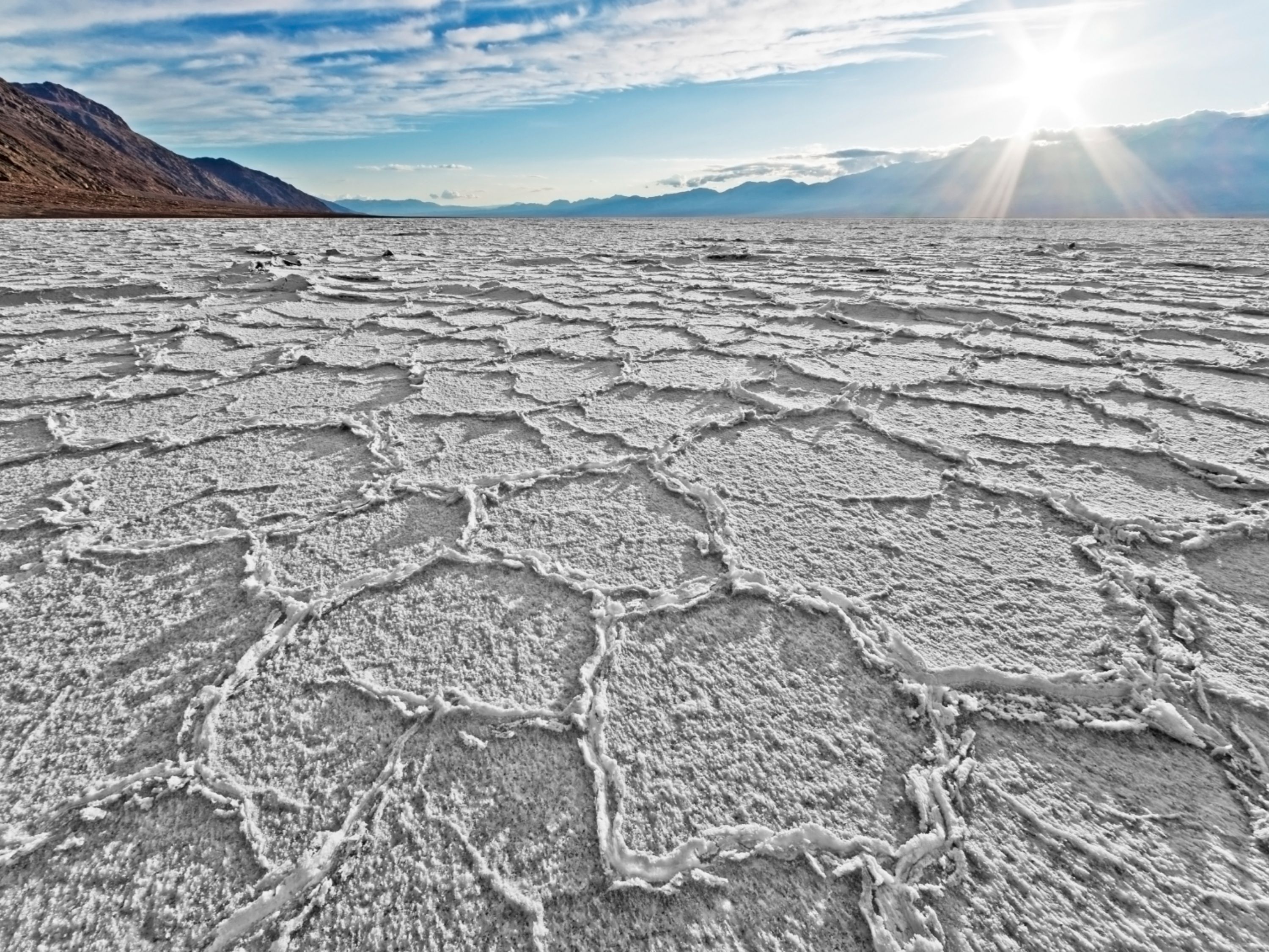
This is Badwater Basin, home to salt flats which spread out across the desert for a whopping 200 square miles. At 282 feet below sea level, this basin is the lowest point in North America.
What's not included
Park Passes
Available languages
Audio guide
EN
FR
Reviews breakdown
Viator
4.1
10 reviews
5★
6
4★
1
3★
2
2★
0
1★
1
Tripadvisor
4.3
23 reviews
5★
13
4★
6
3★
2
2★
1
1★
1
Important information
Public transportation options are available nearby
Suitable for all physical fitness levels
How To Access: After booking, you’ll get an email and text with setup instructions and password (search “audio tour” in emails and texts). • Download the separate tour app by Action • Enter the password sent by email and text. • MUST download the tour while in strong wifi/cellular. • Works offline after download.
How to start touring: Open Action’s separate audio tour guide app once onsite. • If there is just one tour, launch it. • If multiple tour versions exist, launch the one with your planned starting point and direction.
Go to the starting point No one will meet you at the start. This tour is self-guided Enter the first story’s point and the audio will begin automatically Follow the audio cues to the next story, which will also play automatically. Enjoy hands-free exploring. If you face audio issues, contact support. Stick to the tour route & speed limit for the best experience.
Travel worry-free: Use the tour app anytime, on any day, and over multiple days. Start and pause the tour whenever you like, taking breaks and exploring side excursions at your own pace. Skip anything you don’t care about or explore bonus content for everything that interests you
Savings tips: Driving tours: purchase just one tour for everyone in the car
Buy once, use for one year! Ideal for extended visits and return trips over the next 12 months.
Please note that an entrance fee is required to visit Death Valley National Park. This fee grants access to the park for seven consecutive days and is not included with this tour.
Audio Setup: Connect your phone to your car's stereo system using Bluetooth, USB, or AUX. For the best experience, consider using headphones for walking tours. Audio playback is compatible with Apple CarPlay, with navigation features coming soon. Support for Android Auto is also on the way.
For the best experience, please use an iPhone running iOS 15 or later, an Android device running version 9 or later, or an iPad/tablet with GPS and cellular connectivity, as these are recommended for navigation.
Important Travel Notice: Government shutdowns may temporarily affect national parks and certain attractions. In addition, recent flooding has closed Badwater Road, North Highway, and Bonnie Clare Road; pedestrian and bicycle access may be limited during repairs. Conditions can change quickly, so please check official park alerts before and on the day of your visit.
Meeting point
Start on CA-190 at Towne Pass, 11 miles east of Panamint Springs. Continue east toward Stovepipe Wells and Furnace Creek. This is the suggested starting point. We’re not affiliated with nearby businesses. The audio starts automatically—check your email/text for setup.
Important notes
1. Find The Setup Instructions NOW:
• Download the App: actiontourguide.com/app
• Find Your Password: Search your email or text messages for “Action Tour Guide”
• Enter Password: Open the app and enter your 8-digit password
• Download the Tour NOW while you have Wi-Fi or cell service
• Offline Ready: Once downloaded, the tour works without internet
• Need Help? Visit: actiontourguide.com/redeem
2. Download The Tour NOW:
• Download NOW over WiFi or cellular data ahead of your trip.
• Don’t wait until travel day - your tour is VALID FOR ONE YEAR from purchase.
• Your password redemption is limited to the number of travelers booked. Please enter the same password on each device.
3. Audio Tour Tips:
• This is a self-guided audio tour - no one will meet you at the starting point.
• Entrance and attraction tickets are not included. Please book those separately.
• Curious how it works? Watch a quick video here: actiontourguide.com/tutorial
• For the best audio, connect to the car stereo via Bluetooth, USB, or Aux, or listen from your phone speaker.
• CarPlay and Android Auto aren’t supported yet.
• Valid for 12 months - listen to your tour on any day without changing your travel date or rebooking!
4. Help & Support:
• Visit our FAQs: actiontourguide.com/faq
• Chat online: actiontourguide.com
• Call: 1-714-333-0534
• Email: support@actiontourguide.com
About Palm Springs
Palm Springs is a desert resort city in Southern California known for its hot springs, stylish hotels, golf courses, and spas. It's a popular destination for outdoor activities, mid-century modern architecture, and a vibrant LGBTQ+ community.
Top Attractions
Palm Springs Aerial Tramway
A scenic tram ride from the desert floor to the mountaintops, offering stunning views and access to hiking trails.
Nature/Adventure
2-3 hours
Moderate
Palm Springs Art Museum
A premier destination for modern and contemporary art, architecture, and design, housed in a striking mid-century modern building.
Museum/Art
1-2 hours
Moderate
Joshua Tree National Park
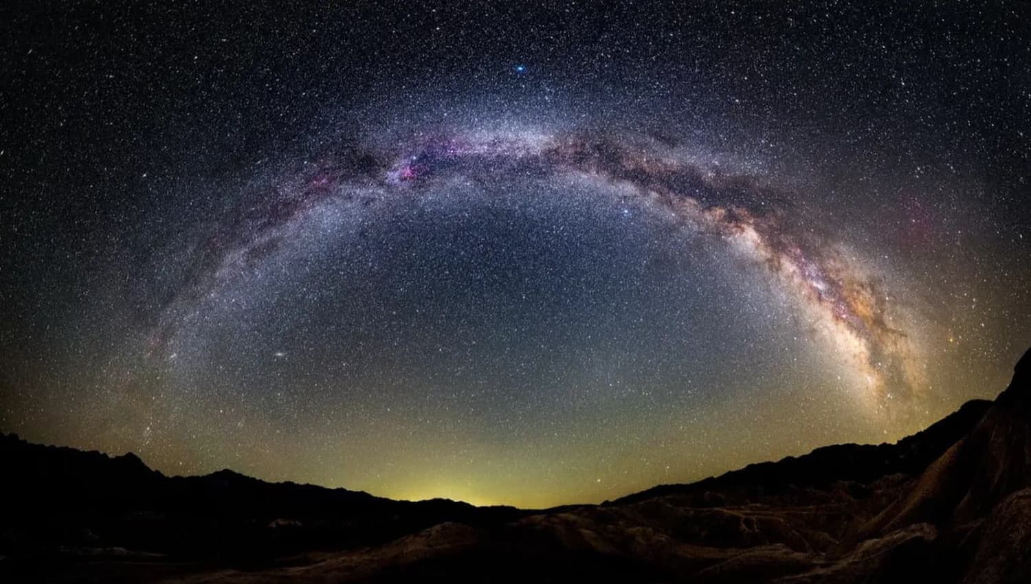
A unique desert landscape with iconic Joshua trees, rock formations, and stargazing opportunities.
Nature/Adventure
Full day
Free entry for some areas, moderate for others
Palm Springs Walk of Stars
A tribute to celebrities who have made significant contributions to the entertainment industry, with stars embedded in the sidewalks of downtown Palm Springs.
Historical/Cultural
30 minutes to 1 hour
Free
Must-Try Local Dishes
In-N-Out Burger
A California classic, known for its fresh, high-quality burgers and fries.
Fast Food
Vegetarian options available
Chef's Table at The Parker
A fine dining experience featuring seasonal, locally sourced ingredients and innovative dishes.
Dinner
Vegetarian and vegan options available
Palm Springs Caesar Salad
A local twist on the classic Caesar salad, often featuring fresh greens, avocado, and a unique dressing.
Lunch/Dinner
Vegetarian
Popular Activities
Hiking
Rock climbing
Mountain biking
Spa treatments
Golfing
Poolside lounging
Art museum visits
Architectural tours
Best Time to Visit
October to April
This is the most popular time to visit with pleasant temperatures and outdoor activities in full swing.
15°C to 30°C
60°F to 85°F
Practical Information
Language
- Official: English
- Widely spoken: Spanish
- English: Widely spoken
Currency
US Dollar (USD)
Time Zone
Pacific Time Zone (PT, UTC-8)
Electricity
120VV, 60HzHz
Safety Information
Overall Safety Rating: Generally safe
Palm Springs is generally safe, but standard precautions should be taken to ensure a secure visit.
Important Precautions:
- • Keep valuables secure
- • Be cautious in isolated areas at night
- • Use reputable tour operators
Getting there
By air
- Palm Springs International Airport • 3 miles from city center
By train
Palm Springs Station
By bus
Palm Springs Transit Center
Getting around
Public transport
Affordable and convenient for getting around, but schedules may be limited.
Taxis
Available • Apps: Uber, Lyft
Rentals
Car, Bike, Scooter
Neighborhoods
Downtown Palm Springs
The Historic District
South Palm Springs
Day trips
Joshua Tree National Park
35 miles • Full day
A unique desert landscape with iconic Joshua trees, rock formations, and stargazing opportunities.
Salton Sea
45 miles • Half day
A unique and somewhat eerie destination known for its shrinking lake and diverse birdlife.
Cathedral City
10 miles • Half day
A vibrant city known for its murals, festivals, and diverse dining options.
Festivals
Palm Springs International Film Festival • January
Palm Springs Pride • November
Palm Springs VillageFest • Thursday evenings year-round
Pro tips
- Visit the Palm Springs Aerial Tramway for stunning views and hiking opportunities
- Explore the mid-century modern architecture with a guided tour
- Enjoy the vibrant nightlife and LGBTQ+ friendly atmosphere
- Take advantage of the numerous golf courses and spas
- Visit nearby Joshua Tree National Park for a unique desert experience
From $25
per person
Price varies by option
Secure booking
Free cancellation available
Instant confirmation