The Malagasy Summits
Active
4h - 1d
For a full refund, cancel at least 24 hours before the scheduled departure time.
Instant confirmation
Mobile or paper ticket accepted
About this experience
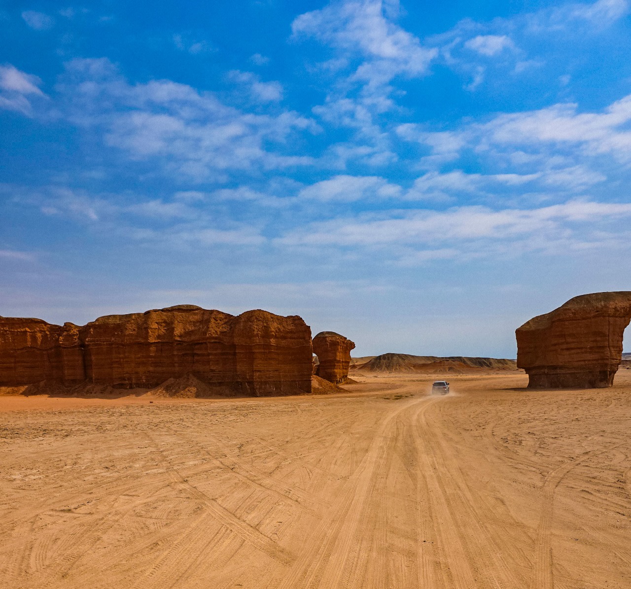
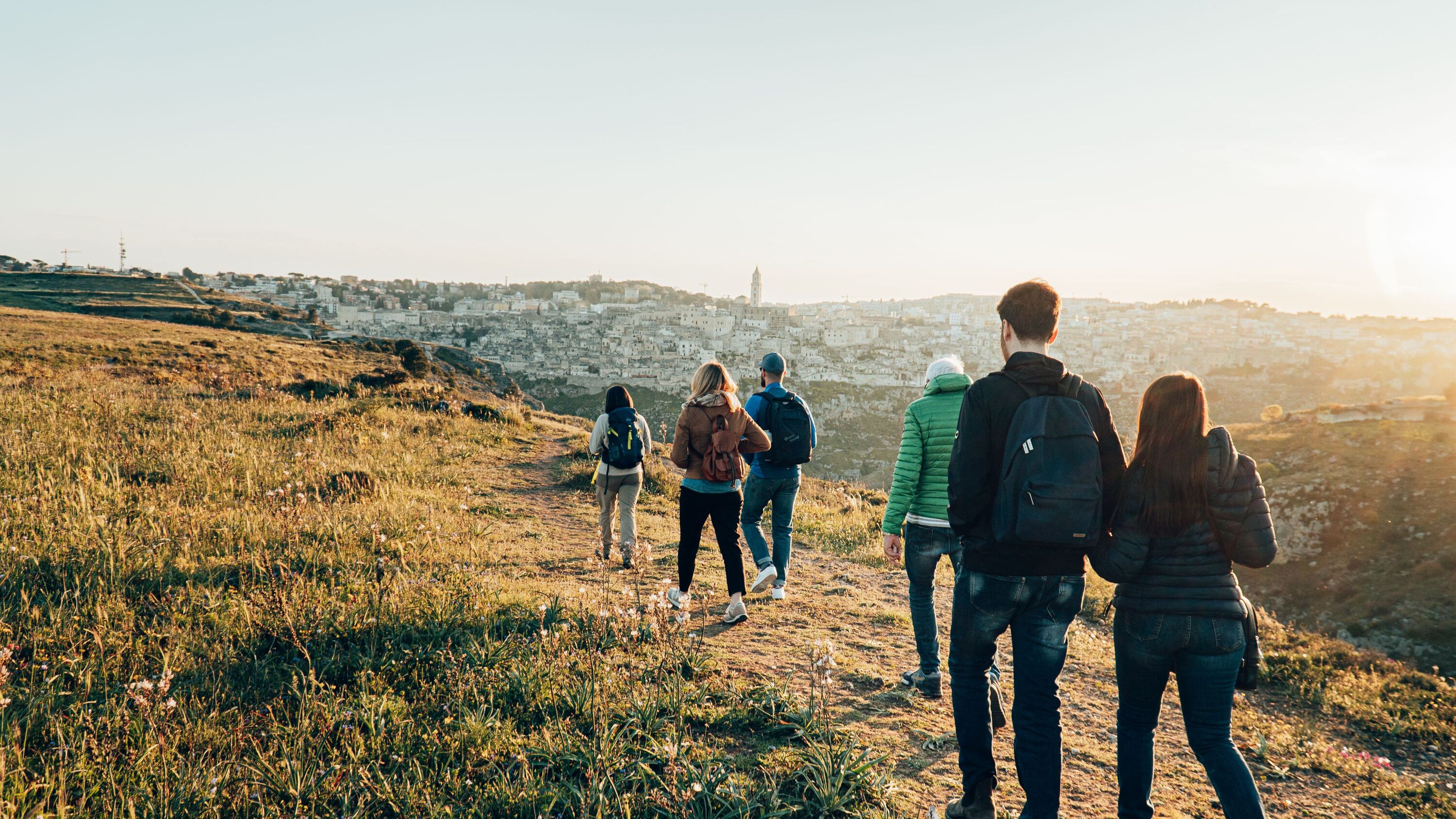
Hiking and high mountain lovers. Discover one of the most beautiful granite massif in Madagascar. A 4-day trek aloft in this massif where many Malagasy legends are born. An adventure which will allow you to climb the 2nd peak of Madagascar but which will allow you to discover one of the most beautiful cliffs in the world, the Tsaranoro and its vertical 800m.
Available options
The Malagasy Summits
Pickup included
What's included
Private transportation
Local Park Guide
All Fees and Taxes
Hotel in the Tsaranoro Valley
Lunch
Dinner
carriers
Breakfast
Camping right
Tents and Mattresses
Enter Andringitra National Park
Detailed itinerary
1
Day 1: Fianarantsoa - Andringitra Approx. 95 km of road including 45km of track
Duration: 4h of walking Difficulty: Not Difficult Elevation gain: 350 meters
Departure for Andringitra National Park.
In Ambalavao, visit the handcrafted paper factory Antemoro. This vegetable paper made from the bark of the Avoha mulberry tree was introduced to Madagascar in the 15th century by the Arabs and is still produced today using the same process in this small workshop in Ambalavao. And departure for the Anja reserve (located +/- 10 km) to observe the lemurs.
Continuation by a sometimes difficult track but with splendid landscapes, we head to the heart of the Andringitra park. This huge massif is in front of us and bars the horizon of its granite ridges. You thus enter the Namoly valley dominated by the cliffs of the Andringitra massif, in which you spot two large waterfalls. Go down across the Zomandao River to reach a small clearing. This is the place of your first bivouac, Belambo, which means a lot of wild boars in Malagasy
2
Day 2: Andringitra National Park
Duration: 6 hours of walking Difficulty: Not very difficult Ascent: 750 meters
Description:
Your discovery of the park begins with a small morning loop in the forest to access the feet of the Zomandao waterfalls. The water here is a great wealth and you are in a tropical rain forest, typical of the eastern rain climate and very different from the dry valley forest of the camp valley. Through abundant vegetation where medicinal plants from Madagascar, Orchids, Ferns, Phylipias and Calenchoees rub shoulders, you reach the edge of the river. There is a cave and its remains, the past home of zebu guardians before the forest was protected. After a point of view on the circus and its waterfalls, you plunge back into the vegetation composed little by little of large trees of the family of Dombeyas and Agoryas, in which many lianas intermingle. You also pass by canals that irrigate rice paddies in the Namoly valley. The path leads to the impressive Andrianbavy waterfall or the Queen's Waterfall. In the dry season, you can cross the torrent to approach the bottom of the second a little further, the Andriandahy waterfall or Cascade du Roi. The names of these Sacred Waterfalls, 250 and 300 meters high, result from the coming of the Queen and King of Ambalavao, in search of pure water which allowed them, under the advice of a healer, to give birth of their eight children.
After this walk, you turn back to climb quietly on the plateau overlooking this circus. At the end of the climb, a superb view opens out before you over large granite cliffs, the supports of the famous Pic Boby. On this immense meadow of altitude grow only different varieties of Phylipias as well as beautiful Orchids. You then begin its crossing to the South, passing by the magnificent pools of Andranolava. Ideal place to relax, the less chilly can also swim there.
To reach the site of the camp, you continue walking towards the cliffs, in the company of many birds, most of them endemic. You cross the river one last time at a place called Andrianbola or Cascade du Prince, then you come to a small torrent. You finally go up the latter to arrive at the place of your second bivouac, Andriampotsy, meaning white waterfall, where you are at the foot of the Andringitra cliffs
3
Day 3: Andringitra National Park
Duration: 8 hours of walking Difficulty: Difficult Elevation gain: 858 meters
Description:
Now is the time to climb the highest point of the Andringitra range. A path, fitted out with 3000 steps, allows you to cross the cliffs and access the famous peak. It begins by crossing several torrents and you notice on its border some Aloes, Tree Ferns, pretty Hibiscus as well as the very rare Drosera, a small carnivorous plant of wetlands. You also observe the grooves of the rocks, due to the erosive action of the water. You then arrive at a pass, from where you can finally discover the object of your hike. From there, the path descends into a very humid basin, where Mosses, Lichens and certain Phylipias proliferate. After crossing it, a final steep slope on the slabs allows you to reach the summit of Pic Boby. You are at 2,658 meters above sea level, on the second highest peak in Madagascar. His name is that of the dog that accompanied the first group of geologists to go there. But it is also called Imarivolanitra, which means close to the sky in Malagasy. If you are lucky not to be in the clouds, a panoramic view of the entire region is available to you: the park and the Isalo massif in the South, the Tsaranoro massif and the Bonnet mountain of Bishop in the West, the South Gate and the Circus of Ambalavao in the North, and it is sometimes even possible to distinguish the Coast in the East You have of course a panorama on the Andringitra massif, and in particular on Pic Bory.
After this unforgettable moment, you descend by the same path and pass through the camp to cross the plateau, this time towards the North West. The path gradually leads you to a small pass. You thus arrive on a small grassy plateau, which you travel quickly to enter the Plateau des Extraterrestres or Plateau des Lumières. In the lunar atmosphere of this granite expanse dotted with small natural pools, you can admire the stacking of stones in balance. You will find here the vegetation of the western slope: Palm trees, Paws of Hen and Calencoees. The path takes you to the north of the plateau, from where you rediscover the Tsaranoro massif and the Sahanambo valley.
You then descend from the Andringitra massif into a forest of ferns and wild palm trees, to win your third and last bivouac. To name Iataranomby, the place where the zebus come to drink, the camp is located in a corner of a meadow bordering a pretty little river.
4
Day 4: Andringitra National Park - Tsaranoro Valley
Duration: 4 hours of walking Difficulty: Not very difficult Ascent: 250 meters
Description:
You leave the camp, leaving the massif and the Andringitra National Park behind you. You then walk through large meadows, used as pasture for zebus, and overlooking the southern part of the Sahanambo valley.
A slightly steeper path then descends into the camp valley on reaching the village of Mananishoa. You then cross the Sahanambo river to reach Morarano, where a market is held once a week. From this village, you take the carriage track which takes you back to the camp bypassing the Chameleon.
If you are not too tired, do not miss a visit to the only dispensary in the valley between Soavahiny and Andonaka, as well as the Tsaranoro School just before joining the camp. Night at the hotel
5
Day 5: Tsaranoro Valley
Possible activities: picnic provided
- Circuit Mont Caméléon: From the camp, there is a 4 hour walk to reach the top of the Caméléon. On the last part of the climb, there is a difficult passage: you must not be dizzy! Upon arrival, you will have a superb view of the Tsaranoro Valley.
- Tsaranoro circuit: You leave early in the morning. From the camp, there are 4 to 4 and a half hours of walking to reach behind the top of the Tsaranoro (Mount Tsaranoro itself is only accessible by climbing). In the middle of the hill you will find the Bara tombs inserted in the hill itself. On the last part of the climb, there is a difficult passage. Upon arrival, you will have a superb view of the mountains of South Malagasy.
- THE PARAGLIDER IN THE VALLEY. An exceptional view over the valley! The valley offers 5 paragliding jump points, depending on the wind. Baptisms are possible. For the sake of efficiency, please notify us at least 48 hours in advance if you plan to jump in a paraglider.
Return to Fianarantsoa in the late afternoon.
End of our services.
What's not included
Bottled water
Mountain sleeping bag
Available languages
Guide guide
EN
IT
FR
Important information
Public transportation options are available nearby
Not recommended for travelers with spinal injuries
Not recommended for pregnant travelers
Not recommended for travelers with poor cardiovascular health
Travelers should have a high level of physical fitness
Meeting point
In front of the Sudmadatrek Voyages agency office
About Madagascar
Madagascar, the world's fourth-largest island, is a land of astonishing biodiversity and unique landscapes. Known as the 'Eighth Continent,' it's home to over 90% of its wildlife found nowhere else on Earth, including lemurs, chameleons, and baobab trees. The island offers a mix of tropical beaches, lush rainforests, and dramatic highlands, making it a paradise for nature lovers and adventure seekers.
Top Attractions
Andasibe-Mantadia National Park
This national park is famous for its lush rainforests and diverse wildlife, including the iconic indri lemur. The park offers excellent hiking trails and guided tours.
Nature
2-3 days
Moderate
Avenue of the Baobabs
This iconic avenue features towering baobab trees, creating a surreal and breathtaking landscape. It's a popular spot for sunrise and sunset photography.
Nature
Half-day visit
Free
Isalo National Park
Known for its dramatic sandstone formations, deep canyons, and natural pools, Isalo National Park offers excellent hiking and swimming opportunities.
Nature
2-3 days
Moderate
Nosey Be
This picturesque island offers beautiful beaches, clear waters, and a relaxed atmosphere. It's a popular spot for diving, snorkeling, and whale watching.
Beach
3-5 days
Moderate to Expensive
Ranomafana National Park
This national park is known for its diverse wildlife, including the golden bamboo lemur. The park offers excellent hiking trails and guided tours.
Nature
2-3 days
Moderate
Must-Try Local Dishes
Romazava
A hearty stew made with leafy greens, meat (usually pork, beef, or chicken), and sometimes lemongrass and ginger.
Main Dish
Contains meat, can be made vegetarian
Ravitoto
A dish made with pork, cassava leaves, and sometimes coconut milk, often served with rice.
Main Dish
Contains pork, not suitable for vegetarians
Laoka
A variety of side dishes made with vegetables, meat, or fish, often served with rice.
Side Dish
Varies, can be vegetarian or contain meat
Mofo Gasy
A type of fried dough, similar to a beignet, often served for breakfast with tea or coffee.
Breakfast
Vegetarian
Popular Activities
Canoeing and kayaking on the Tsiribihina River
Caving in the Anjohibe Caves
Hiking in national parks
Beach lounging in Nosy Be
Sunset viewing at the Avenue of the Baobabs
Spa and wellness treatments in luxury resorts
Visiting historical sites like Ambohimanga
Exploring local markets and crafts
Best Time to Visit
April to October (Dry Season)
The dry season is the best time to visit Madagascar, offering pleasant weather and ideal conditions for wildlife viewing and trekking. This is the peak tourist season, especially from June to September.
20-25°C (68-77°F)
68-77°F
Practical Information
Language
- Official: Malagasy, French
- Widely spoken: English (limited)
- English: Limited
Currency
Malagasy Ariary (MGA)
Time Zone
GMT+3
Electricity
220VV, 50HzHz
Safety Information
Overall Safety Rating: Exercise caution
Madagascar is generally safe for travelers, but petty crime and scams can occur, especially in crowded areas and tourist hotspots. Exercise caution and be aware of your surroundings.
Important Precautions:
- • Be cautious of your belongings in crowded areas
- • Use reputable taxi companies or hotel-recommended services
- • Avoid walking alone at night
Getting there
By air
- Ivato International Airport • 13 km (8 miles) from Antananarivo
By train
Antananarivo Train Station
By bus
Antananarivo Bus Terminal, Toamasina Bus Terminal
Getting around
Public transport
Shared minibuses are the most common form of public transport. They are inexpensive but can be crowded and uncomfortable.
Taxis
Available • Apps: None widely used
Rentals
Car, Bike, Scooter
Neighborhoods
Antananarivo (Tana)
Toamasina (Tamatave)
Fianarantsoa
Day trips
Ambohimanga
20 km (12 miles) from Antananarivo • Half-day to Full-day
A UNESCO World Heritage Site, Ambohimanga is a royal hill and former capital of the Kingdom of Madagascar. It offers a glimpse into the country's rich history and cultural heritage.
Percé Rock
5 km (3 miles) from Ifaty • Half-day
Percé Rock is a famous rock formation in the Andavadoaka area, known for its unique shape and beautiful surroundings. It's a popular spot for snorkeling and diving.
Tsiribihina River
300 km (186 miles) from Antananarivo • Full-day to Overnight
The Tsiribihina River offers exciting canoeing and kayaking opportunities, with stunning landscapes and opportunities to experience traditional Malagasy village life.
Festivals
Alahamady Be • March (New Year's Day in the Malagasy calendar)
Donia Festival • July (dates vary)
Fetra Gasikara • August (dates vary)
Pro tips
- Learn a few basic phrases in Malagasy to enhance your interactions with locals
- Hire local guides for national park visits and wildlife tours for a more informative and enriching experience
- Pack lightweight and breathable clothing, as well as insect repellent and sunscreen, due to the tropical climate
- Carry small denominations of local currency for small purchases and transport
- Be flexible with your itinerary, as travel in Madagascar can be unpredictable due to road conditions and weather
From $25
per person
Price varies by option
Secure booking
Free cancellation available
Instant confirmation