Grand Canyon North Rim Full-Day Self-Guided Tour
Active
1h - 16h
For a full refund, cancel at least 24 hours before the scheduled departure time.
Instant confirmation
Mobile or paper ticket accepted
About this experience
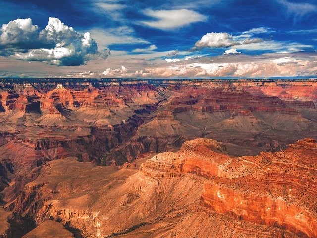
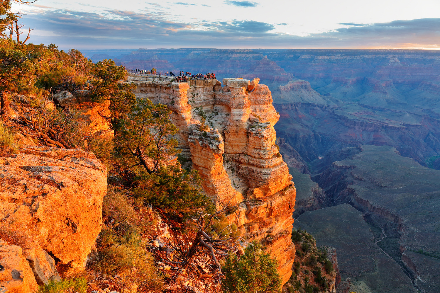
Experience the natural wonder of the Grand Canyon like never before on our Grand Canyon North Rim Audio Driving Tour!
Along the way, you'll be surrounded by breathtaking views of the canyon's rugged cliffs, colorful rock formations, and stunning desert landscape.
Our expert audio guide will provide fascinating insights into the history and geology of this awe-inspiring natural wonder, including the ancient cultures that once lived here and the natural forces that shaped this incredible landscape over millions of years.
It's like having a tour guide through your phone! You'll have the chance to get out and explore the canyon at multiple stops, taking in the sweeping vistas from lookout points and hikes along the way! Stop & go as you please.
*Download the Shaka Guide app to access your purchased tours.*
Available options
Grand Canyon North Rim Full-Day Self-Guided Tour
What's included
Tours NEVER expire
Offline Audio Guided Tour: Hours of audio narration with stories, travel tips and music
Offline map (map and GPS work completely offline - no wifi or data needed)
Take the tour when you want - download the tour and choose the day that works best for you
Tour highlights with activity and restaurant recommendations
Turn-by-turn directions using GPS
Freedom to explore at your own pace - pick the stops you want, skip the ones you don’t
Audio narration that plays automatically as you drive
Detailed itinerary
1
Constructed in 1927, the Navajo Bridge provided easier travel and trade access from Utah to Arizona across the Colorado River.
These days it's a historic landmark that you can walk across andmarvel at the river below.
2
Built by The Betsy and Bill Russel in 1927, this one-time makeshift shelter became a thriving lodge for travelers and a unique roadside attraction.
3
Spanish priests Francisco Dominguez and Silvestre Escalante, explored this area in 1776. They were in search of a possible trade route from Mexico to California, and they may have been the first Europeans to see the Arizona Strip on their expedition in 1776
4
Stop 4
Pass by
Vermilion Cliffs National Monument is a vast wilderness area spanning nearly 300,000 acres.
While most drivers will choose to continue their journey straight to the North Rim, this stop marks the beginning of rugged 4-wheel drive routes leading to attractions like Wire Pass Day Hikes and the Condor Viewing Site.
5
You'll soon reach a scenic turnout offering a final breathtaking view of the Vermillion Cliffs and the House Rock Wildlife Area.
This stop provides a perfect opportunity to savor the rocky landscape before we transition into the lush Kaibab National Forest, marking a dramatic change in elevation and environment.
6
The National Park Service's website(nps.gov/pisp) sums this unique national monument best: "The rich history of Pipe Spring and its flowing water comes alive as you explore the traditions of the Kaibab Paiute and the Mormon settlers through the museum, historic fort, cabins, and garden. Hike the Ridge Trail to enjoy geologic wonders, plants, and wildlife. Attend living history demonstrations and talks and be sure to visit with our amazing ranch animals!
7
One of the four visitor centers within the Grand Staircase Escalante National Monument.
The Kanab Visitor Center focuses on the geology and archeology of the Grand Staircase Escalante National Monument.
8
There’s only one stop for visitors coming from Fredonia before they arrive at Jacob’s Lake, and that’s the Le Fevre Overlook.
This roadside stop looks out at the red-orange bands of the Grand Staircase Escalante. There’s even binoculars so you can admire the staircase with a better, closer view!
9
The Jacob Lake Inn is a great place to stretch your legs and grab a bite to eat. They serve breakfast, lunch, and dinner in their dining room, and their on-site bakery is famous for its giant cookies.
10
This 80’ Aermotor steel tower with a 7’ x 7’ metal cab was built by the Civilian Conservation Corps in 1934 and used by wildland firefighters and rangers to spot far-off wild fires. It was decommissioned in the 1970s but is still open to visitors.
11
The Country Store is a great place to load up on supplies, snacks, and gas before going out to hit the trails.
12
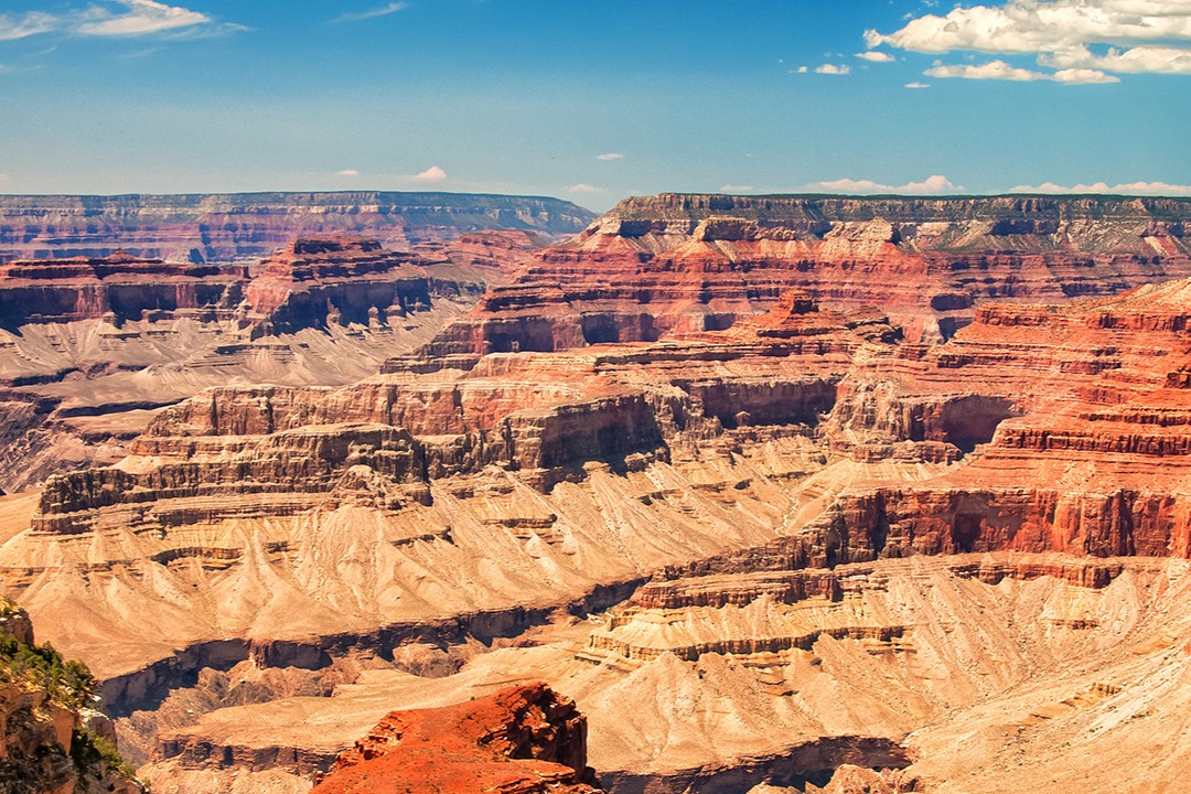
Point Imperial has the distinction of being the highest point on the North Rim. At 8,803 feet above sea level, you'll be able to see Boundary Ridge and its central peak Saddle Mountain to the North. The Nankoweap Trail runs across the lower ridge, and views of Mount Hayden, Hancock Butte and Alsap Butte are visible from the upper part of the ridge.
13
A quiet viewpoint along Cape Royal Drive, Vista Encantada is a picnic area that's blanketed in wildflowers and offers views of Nankoweap. The viewpoint of Vista Encantada looks out over the Walhalla Plateau. On clear days, youmay be able to see the Painted Desert in the east.
14
Stop 14
Another viewpoint along Cape Royal Road. Roosevelt Point is accessed through a very short walk and has resting benches. Despite the high ridge, a fair amount of the scenery to the north is visible including the furthest section of the Grand Canyon, where the Colorado River forms an unbranched gorge just a mile or so across, cutting into the flat desert plain between the Vermilion and Echo Cliffs.
15
This is a 4-mile out and back trail leads to Cape Final. The trail is rated easy, which means it's relatively flat and shaded. The first part of the trail winds through the Ponderosa pine forest until you get to Cape Final Overlook, which provides expansive views of the North Rim. Many people say that this is the best overlook on the North Rim.
16
The Walhalla Ruins--or Walhalla Glades--was once the summer home of the Basketmakers during the Pueblo period. Here you'll be able to tour 10 rooms that have been left behind, and attend ranger-led talks and tours through the artifacts!
17
The Walhalla Overlook is just across the road from the Ruins. Here, you'll be treated to views of the Echo Cliffs, the Painted Desert, and the Little Colorado River Gorge.
18
Angel’s Window Viewpoint is a great place to get a wide-angle photo of the stone arch. If you wanna check it out, then park in the pullover on your left.
19
Some of the most spectacular overlooks at the North Rim are tucked away on this nine and a half mile paved road.
20
Stop 20
Moderately challenging 32.5 mile out-and back hike
21
Named for artist Gunnar Widforss, this trail is a long one, ut a flat one. It's 10 miles of relatively flat trail.
The first part is slightly uphill through forest. It will then follow the rim of the canyon before dropping down into the valley and then to a final plateau for the best views.
22
The Uncle Jim Trail is a moderate 4.7 out-and-back trail that leads to the Uncle Jim Trail Overlook and views of the canyon.
This trail has several uneven points and is a popular trail for guided mule rides, so watch your step!
23
Stop 23
Pass by
This is the most visited viewpoint on the North Rim! Bright Angel Point can be accessed behind the Lodge on the Transept Trail.
This is only a half-mile, paved path that leads to the Point, where you'll be treated to view of three peaks named for three Hindu deities:
Deva Temple,
Brahma Temple and
Zoroaster Temple.
24
Plenty of parking here! The North Rim Visitor Center also offers educational programs, interactive exhibits both indoor and outdoor, a large gift shop, ranger information stations and those all-important restrooms, too!
What's not included
Meals and Refreshments
Entrance fee: Grand Canyon North Rim (per vehicle)
Parking Fees
Pipe Spring National Monument
Available languages
Audio guide
EN
Reviews breakdown
Viator
3.8
4 reviews
5★
2
4★
1
3★
0
2★
0
1★
1
Tripadvisor
2.7
3 reviews
5★
0
4★
1
3★
1
2★
0
1★
1
Important information
Wheelchair accessible
Infants and small children can ride in a pram or stroller
Service animals allowed
Transportation options are wheelchair accessible
Suitable for all physical fitness levels
Get Started Easily: • Book Your Tour: Receive a confirmation and easy instructions via email. • Download the App: Follow the simple steps in your email. • Redeem the Tour: Use the redeem code in your email to redeem the tour in the app. • Prepare Ahead: Download the tour using strong Wi-Fi.
Begin Your Journey: • Select Your Tour: Go to the My Stuff tab in the Shaka Guide app to launch the tour. • Start the Tour: Select the tour starting point and follow the GPS instructions. • Follow Shaka Guide: Stick to the suggested route and speed for the best experience.
Why Choose Our Audio Tour: • Cost-Efficient: One tour for the entire vehicle—no per-person fees! • Ultimate Flexibility: Start, pause, and resume on your schedule. • Convenience: Use the tour any day, over multiple days if needed.
Top Features: • Hands-Free: The tour works automatically - GPS-activated stories, directions, and music play as you drive for a seamless experience. • Works Offline: No need for continuous wifi or data. • Reliable Support: Get help via call, chat, or email.
Private and Personalized: • Crowd-Free: Enjoy a private tour with just your group. • Customizable Stops: Pick the stops you want and skip the ones you don’t!
The Ultimate Guided Tour: • Detailed Itinerary: Includes travel tips and recommendations. • Engaging Narration: Captivating stories and history.
What Our Users Say: • “A fantastic way to explore! Easy to use and very informative.” • “Loved the flexibility to stop and go as we pleased. Highly recommend!”
Meeting point
There are two additional starting point options for this tour: Kanab, UT, and Kaibab, AZ. Choose the best starting point for you or join the tour along the route.
Important notes
HOW TO REDEEM YOUR TOUR:
Thank you for purchasing the Grand Canyon North Rim.
Before you start your adventure, you'll need to redeem and download the tour in the Shaka Guide app. Follow the instructions below:
*Please Note: The redeem code is the 10-digit booking reference number on your ticket (located under the barcode).
How to Redeem Your Tour(s):
1. Download the Shaka Guide app from the App Store or Google Play
2. Open the app and sign up or sign in
3. Tap Support
4. Tap Retrieve Purchases
5. Tap Redeem Purchase
6. Enter the 10-digit Booking Reference number (under the barcode on their Viator ticket)
7. Hit Redeem Purchase and download the tour(s)
Once you've redeemed your tour, you'll find it under "My Stuff" in the app.
For a smooth ride, download the tour with wifi before you go.
We can't wait for you to explore with Shaka Guide!
If you have any questions, don't hesitate to reach out to aloha@shakaguide.com or call (808) 201-8138
DOWNLOAD THE APP HERE: www.shakaguide.com/download
About Page
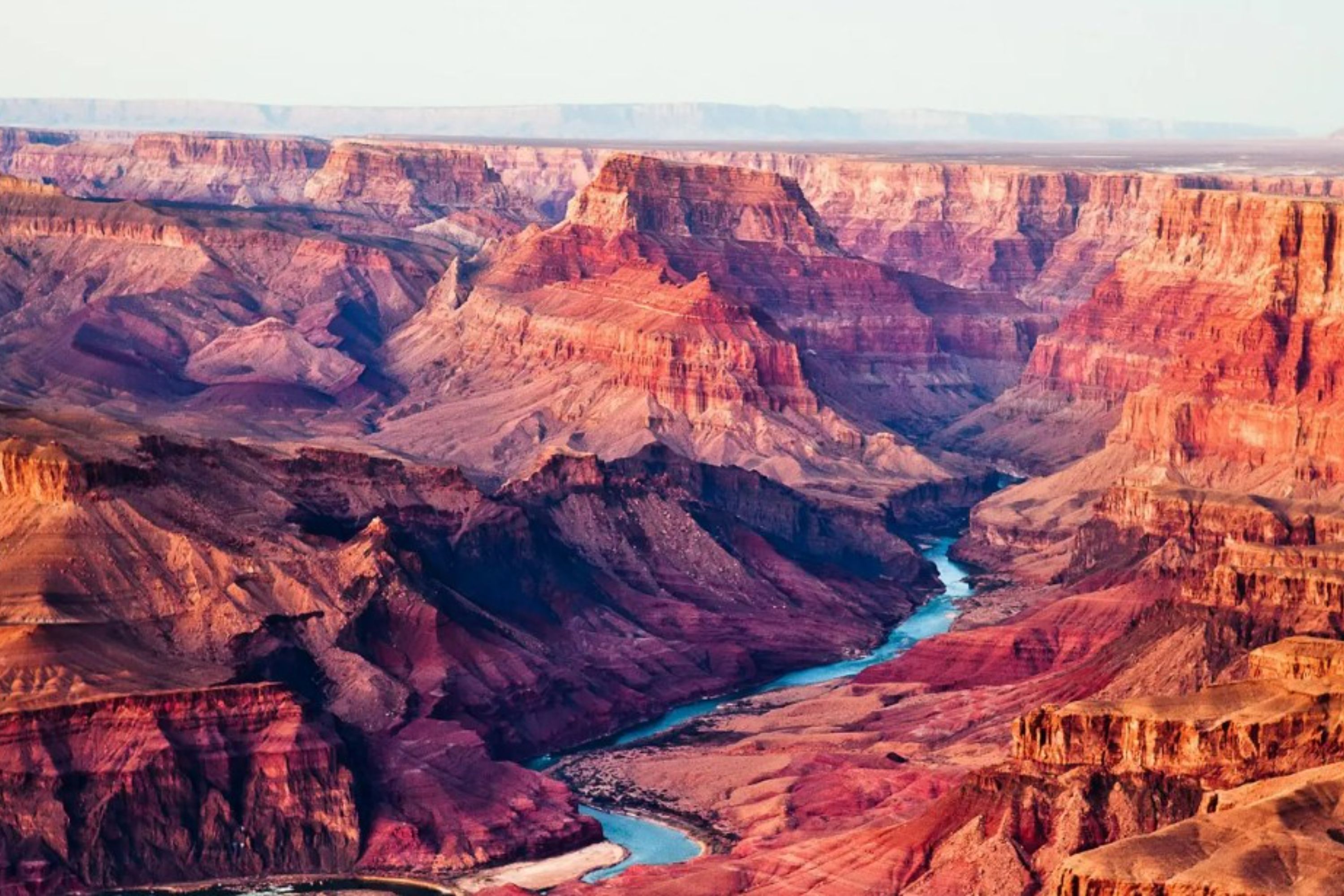
Page, Arizona, is a gateway to some of the most stunning natural wonders in the American Southwest. Located on the southern shores of Lake Powell, this small city offers breathtaking landscapes, including the iconic Antelope Canyon and Horseshoe Bend. It's a paradise for outdoor enthusiasts and photographers.
Top Attractions
Antelope Canyon
Antelope Canyon is a stunning slot canyon known for its beautiful light beams and colorful sandstone walls. It's a must-visit for photographers and nature lovers.
Nature
1-2 hours
Moderate ($50-$80 per person for guided tours)
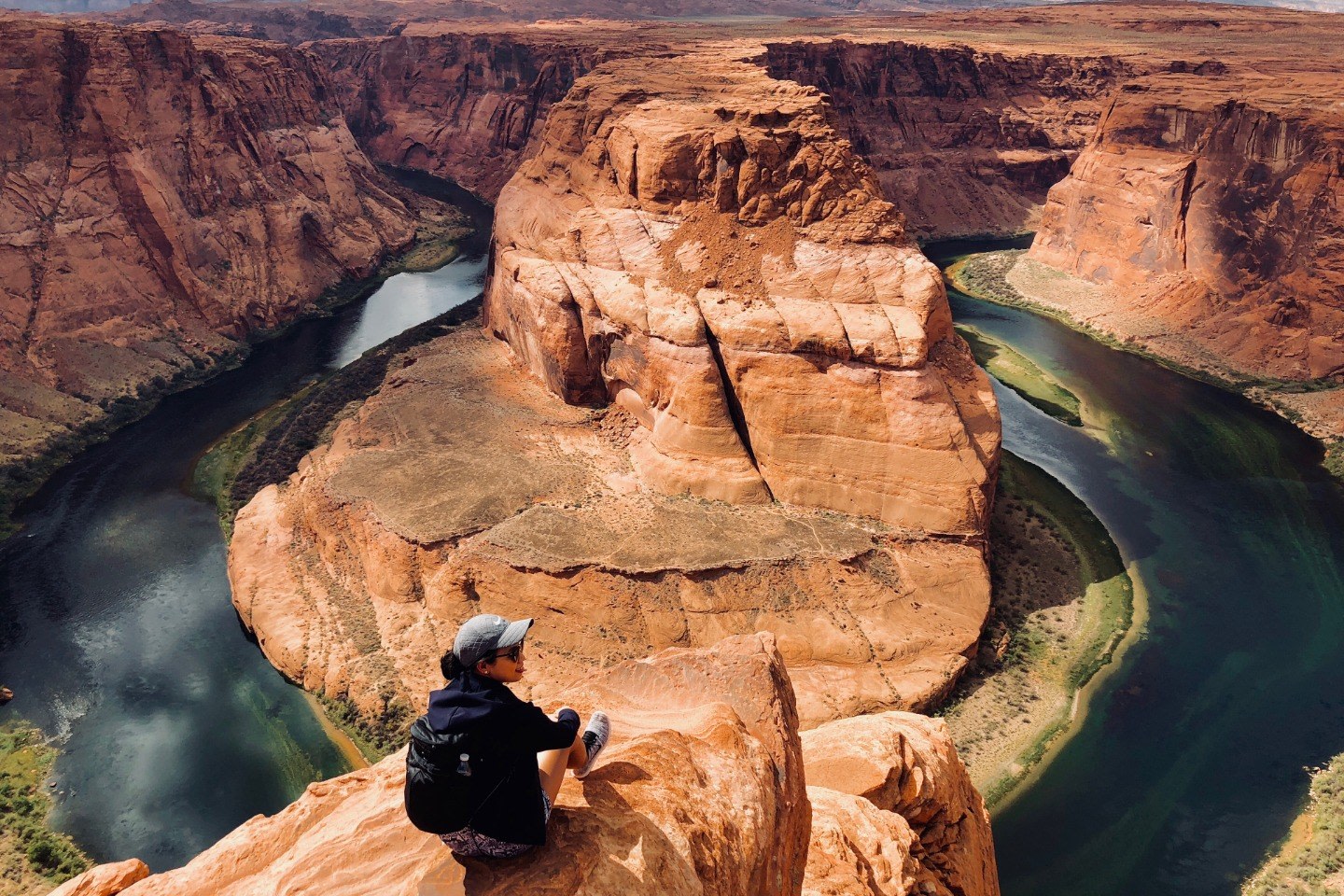
Horseshoe Bend
Horseshoe Bend is a spectacular horseshoe-shaped meander of the Colorado River. It's a popular spot for photography and hiking.
Nature
30 minutes to 1 hour
Free
Lake Powell
Lake Powell is a massive reservoir known for its stunning blue waters and numerous canyons. It's a paradise for boating, fishing, and water sports.
Nature
Half day to full day
Varies depending on activities (rentals can be expensive)
Must-Try Local Dishes
Navajo Tacos
Fried bread topped with beans, meat, and vegetables, a traditional Navajo dish.
Main Course
Can be made vegetarian or vegan
Green Chile Stew
A hearty stew made with pork, green chiles, and potatoes.
Main Course
Contains meat, can be made vegetarian
Prickly Pear Lemonade
A refreshing drink made with prickly pear cactus and lemonade.
Drink
Vegan and gluten-free
Popular Activities
Hiking
Boating
ATV Tours
Scenic boat tours
Sunset viewing at Horseshoe Bend
Spa and wellness services
Visiting Native American cultural sites
Attending local festivals and events
Best Time to Visit
March to May, September to October
The best time to visit Page is during the spring and fall when the weather is mild and pleasant. These seasons offer the best conditions for hiking, boating, and exploring the natural attractions.
10-30°C
50-86°F
Practical Information
Language
- Official: English
- Widely spoken: Navajo
- English: Widely spoken
Currency
US Dollar (USD)
Time Zone
Mountain Time Zone (GMT-7)
Electricity
120VV, 60HzHz
Safety Information
Overall Safety Rating: Generally safe
Page is generally a safe destination, but visitors should take precautions to ensure a safe and enjoyable trip.
Important Precautions:
- • Be cautious of overpriced or misleading tours and services.
- • Stay aware of your surroundings, especially in crowded areas.
- • Keep valuables secure and out of sight.
Getting there
By air
- Page Municipal Airport • 5 miles from city center
- Grand Canyon National Park Airport • 100 miles from Page
By bus
Page Transit Center
Getting around
Public transport
Public buses are available but limited. They are a good option for getting around town.
Taxis
Available • Apps: Uber, Lyft
Rentals
Car, Bike
Neighborhoods
Downtown Page
Wahweap Marina Area
Day trips
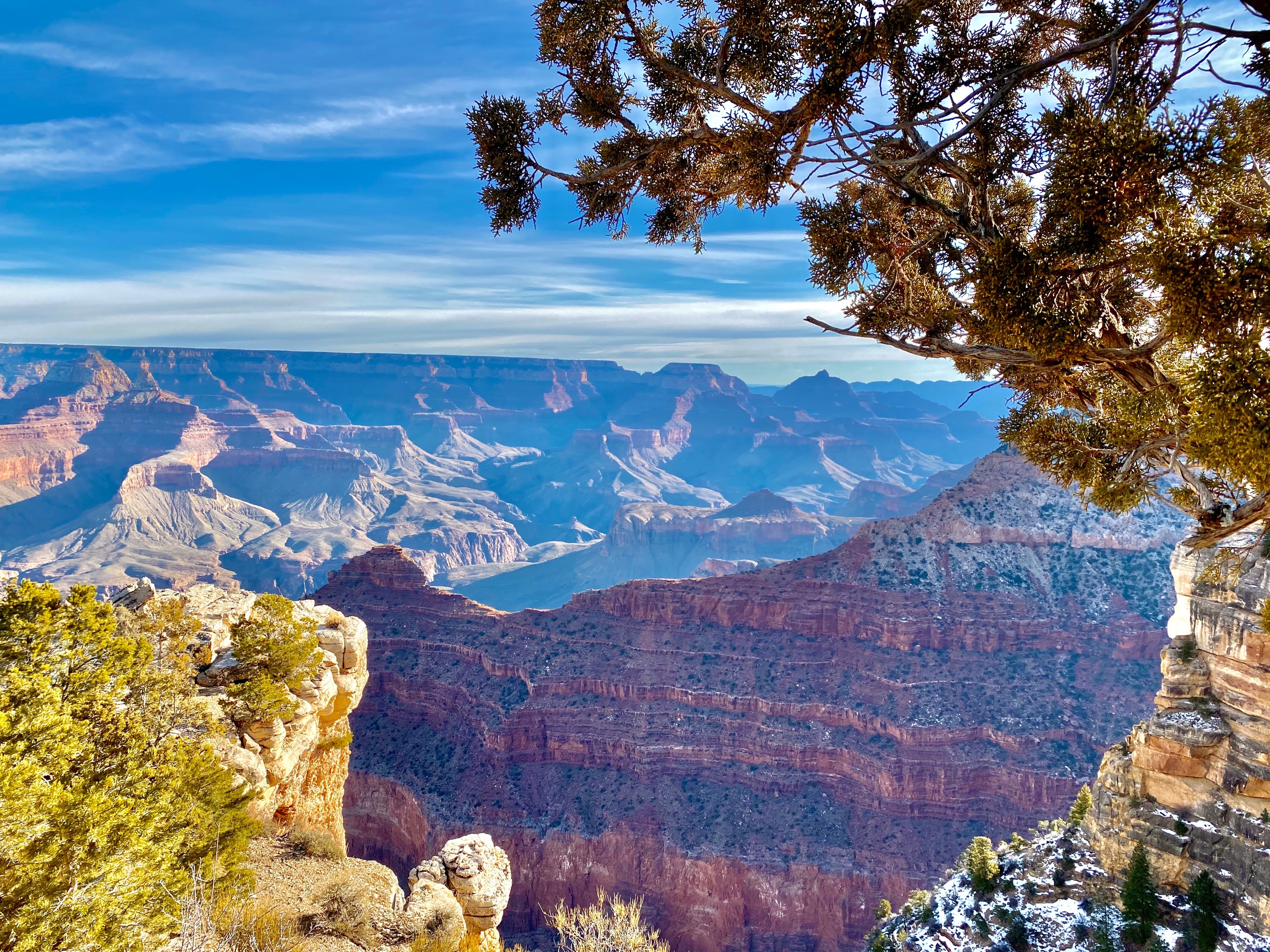
Grand Canyon North Rim
130 miles • Full day
The North Rim of the Grand Canyon offers stunning views and hiking trails. It's a great day trip from Page.
Monument Valley
90 miles • Full day
Monument Valley is a stunning landscape of sandstone buttes and mesas, known for its iconic Western movie scenery.
Festivals
Page Regatta • July
Antelope Canyon Photo Workshop • Various dates throughout the year
Pro tips
- Book tours and accommodations well in advance, especially during peak seasons.
- Bring plenty of water and sunscreen, as the desert climate can be harsh and dehydrating.
- Consider renting a car for flexibility and easier access to attractions and day trips.
- Be mindful of water usage and conservation, as water is a precious resource in the area.
- Respect local customs and traditions, especially when visiting Native American cultural sites.
From $25
per person
Price varies by option
Secure booking
Free cancellation available
Instant confirmation