


Lassen Volcanic National Park Self-Guided Audio Tour
Active
8h - 9h
For a full refund, cancel at least 24 hours before the scheduled departure time.
Instant confirmation
Mobile or paper ticket accepted
About this experience
Discover the geothermal wonders of Lassen Volcanic National Park with our exciting audio tour! Explore bubbling mud pots, steaming fumaroles, and the park’s majestic volcanic landscapes while our guides share fascinating stories about its volcanic history, unique geology, and diverse wildlife.
Learn about the forces that shaped this dynamic terrain and the science behind its geothermal features. Perfect for families, adventurers, and nature enthusiasts, our tour provides an educational and fun experience. Simply download, plug in your headphones, and embark on an unforgettable journey through the extraordinary Lassen Volcanic National Park!
*Download the Shaka Guide app to access the purchased tours*
Available options
Lassen Volcanic National Park Self-Guided Audio Tour
What's included
Tours NEVER expire
Freedom to explore at your own pace
Offline map (no wifi or data needed)
Turn-by-turn directions using GPS
Hours of audio narration with stories, travel tips and music
Audio narration that plays automatically as you drive
Detailed itinerary
1
Located near the park's south entrance, the Kohm Yah-mah-nee Visitor Center features exhibits, a gift shop and cafe and restrooms. You can also grab a trail map and chat with a ranger.
The name of the visitor center comes from the Mountain Maidu word Kohm Yah-mah-nee which means "snow mountain." It's the original name for the volcano we know today as Lassen Peak.
2
Sulphur Works is one of the park's colorful hydrothermal features that you can see right from the road. Take the paved walkway to view steam vents, a boiling mudpot and a landscape tinged yellow, orange and red from mineral deposits.
Remember to tap the map marker to listen to the bonus story "The Aroma of a Volcano" to learn more about this fascinating place!
3
From the small pullout beneath Diamond Peak, you can see Brokeoff Mountain to the west, Lassen Peak to the north and acres and acres of forest land burned in the 2021 Dixie Fire.
The overlook is located at a bend in the road, so use caution when entering and exiting.
4
Emerald Lake gets its name from its striking green color which comes from vegetation that grows in the shallow water.
In the 1930s, park rangers stocked this lovely roadside gem with large rainbow trout. Today, the lake no longer has fish, but its stunning green color still makes a great photo op!
5
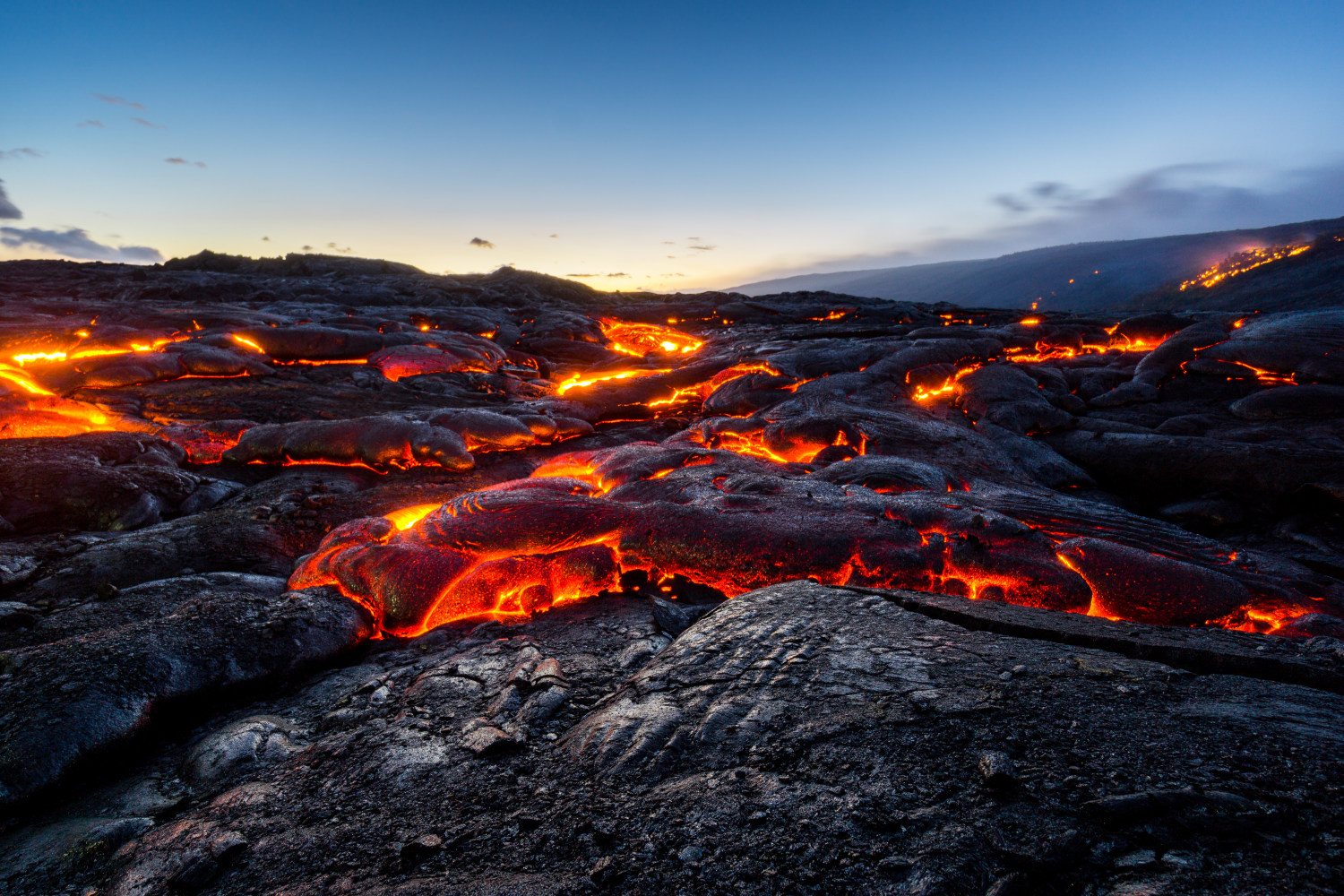
The three-mile roundtrip trek to Bumpass Hell leads to the park's largest hydrothermal area, boasting16 acres of boiling springs, mud pots and roaring fumaroles!
The biggest steam vent, named Big Boiler, is one of the hottest fumaroles in the world--reaching over 300 degrees Fahrenheit.
6
Lake Helen was named after Helen Brodt, the first white woman to summit Lassen Peak back in 1864. This deep blue lake is nestled at the foot of Lassen Peak and reflects the snowcapped mountain above.
Feel free to dip your toes or even go for a swim. But be warned that the lake's crystal clear water is extremely cold!
7
Pull into the large parking area for a view of the world's largest plug dome volcano and namesake of this park.
You can even climb to the top of this sleeping 10,500-ft volcano!
With an elevation gain of almost 2,000 feet, the trail is not for the faint of heart. If you’re interested in tackling this 5 mile-round trip hike, make sure to read the safety information at the trailhead. Pay close attention to what it says about altitude sickness.
8
The Kings Creek Picnic Area is located in a wildflower meadow and is a nice place to take a break and have some lunch. You'll find picnic tables and pit toilets.
The picnic area also features an easy 1.5-mile roundtrip trail to an unusual hydrothermal feature called Cold Boiling Lake. Unlike other hot spots in the park, here you can see gas bubbling up through cold water along the shoreline of this pretty lake.
9
The moderate 3-mile hike to Kings Creek Falls features a spectacular 30-foot cascades. Much of the forest was burned during the Dixie Fire, but life is already beginning to return. Keep your eyes open for wildflowers in the meadows and other evidence of rebirth.
There is limited roadside parking. If you cannot find a spot, we recommend you try again later or skip this hike and do the one to Paradise Meadows instead.
10
Paradise Meadows is a hidden gem tucked away on the northeast side of Lassen Peak. The moderate three-mile round trip hike follows Hat Creek up through a beautiful forest to a large basin surrounded by steep cliffs. Nestled in the basin is an enchanting wildflower meadow that looks straight out of a fairytale. Along the way, you’ll pass a few waterfalls and catch glimpses of Lassen Peak through the trees.
With an elevation gain of 700 feet, be prepared to do a fair bit of climbing. But the heavenly views at the end are so worth it!
11
The blast zone from Lassen Peak's 1915 eruption is known as the Devastated Area. After the blast, this entire forest was leveled and turned into a gray desolate wasteland.
But today, the name Devastated Area no longer matches what you'll see. Over the past century, nature has been hard at work, reclaiming the landscape and breathing new life into a once-desolate area. Plants have risen from the ashes, and wildlife has returned. It’s a testimony of Nature’s power to destroy–and to restore.
Take the short, interpretive walk through the Devastated Area. You'll find picnic tables and restrooms here as well.
12
Pull over to the side of the road and get a photo of the 30-ton boulder named Hot Rock. During one of Lassen's big eruptions, this giant lava boulder ejected out of the magma chamber and flew down the mountain in a rock avalanche to its final resting place here--five miles away!
A few days later, local photographer B.F. Loomis snapped a picture of the rock. Because it was still steaming and hot to the touch, he named it Hot Rock. You can see Loomis' historic photograph of Hot Rock in the Loomis Museum.
13
Turn into the pullout for a view of Chaos Crags and Chaos Jumbles--two more volcanic features that tell of the region's fiery past.
Chaos Crags are plug dome volcanoes, just like Lassen Peak, except they’re very jagged. On the other hand, Chaos Jumbles are the acres of volcanic rocks strewn about between the crags and Manzanita Lake.
14
The Manzanita Lake Area features the Loomis Museum, a gift shop, restrooms, a few lakeside trails and a campground.
It's a great place to get your bearings if you enter the park from the north. And it's also a fun place to just kickback, relax and hang out for the afternoon. You can rent a kayak, swim or walk along Manzanita Lake on the easy 2-mile loop path. You'll find stunning views of Lassen Peak from the lake's north shore.
15
Across the street from the visitor center are two short, easy trails. One circles Reflection Lake and the other loops around Lily Pond. Grab one of the interpretive brochures for the Lily Pond Trail to learn more about the unique plants that live here.
16
The Loomis Museum is where you'll find displays of volcanic rocks, B.F. Loomis' historic photographs and Selena LaMar's Atsugewi basketry. This is also where the rangers hang out, so bring your junior rangers here to earn their badges.
The Loomis Museum was donated to Lassen Volcanic National Park by B.F. and Estella Loomis, two of the park's earliest advocates and supporters.
What's not included
Meals and refreshment
Private Transportation
Entrance Fees
Parking Fees
Available languages
Audio guide
EN
Reviews breakdown
Tripadvisor
5.0
1 reviews
5★
1
4★
0
3★
0
2★
0
1★
0
Important information
Wheelchair accessible
Infants and small children can ride in a pram or stroller
Service animals allowed
Suitable for all physical fitness levels
Starting Points: Park's Northwest Entrance and Southwest Entrance
Get Started Easily: • Book Your Tour: Receive a confirmation and easy instructions via email. • Download the App: Follow the simple steps in your email. • Redeem the Tour: Use the redeem code in your email to redeem the tour in the app. • Prepare Ahead: Download the tour using strong Wi-Fi.
Begin Your Journey: • Select Your Tour: Go to the My Stuff tab in the Shaka Guide app to launch the tour. • Start the Tour: Select the tour starting point and follow the GPS instructions. • Follow Shaka Guide: Stick to the suggested route and speed for the best experience.
Why Choose Our Audio Tour: • Cost-Efficient: One tour for the entire vehicle—no per-person fees! • Ultimate Flexibility: Start, pause, and resume on your schedule. • Convenience: Use the tour any day, over multiple days if needed.
Top Features: • Hands-Free: The tour works automatically - GPS-activated stories, directions, and music play as you drive for a seamless experience. • Works Offline: No need for continuous wifi or data. • Reliable Support: Get help via call, chat, or email.
Private and Personalized: • Crowd-Free: Enjoy a private tour with just your group. • Customizable Stops: Pick the stops you want and skip the ones you don’t!
The Ultimate Guided Tour: • Detailed Itinerary: Includes travel tips and recommendations. • Engaging Narration: Captivating stories and history.
What Our Users Say: • “A fantastic way to explore! Easy to use and very informative.” • “Loved the flexibility to stop and go as we pleased. Highly recommend!”
Meeting point
To get to Shingletown from California, take I-5 North to Redding, then follow CA-44 East for about 30 miles to reach Shingletown.
Important notes
HOW TO REDEEM YOUR TOUR:
Thank you for purchasing the Lassen Volcanic Tour.
Before you start your adventure, you'll need to redeem and download the tour in the Shaka Guide app. Follow the instructions below:
*Please Note: The redeem code is the 10-digit booking reference number on your ticket (located under the barcode).
How to Redeem Your Tour(s):
1. Download the Shaka Guide app from the App Store or Google Play
2. Open the app and sign up or sign in
3. Tap Support
4. Tap Retrieve Purchases
5. Tap Redeem Purchase
6. Enter the 10-digit Booking Reference number (under the barcode on their Viator ticket)
7. Hit Redeem Purchase and download the tour(s)
Once you've redeemed your tour, you'll find it under "My Stuff" in the app.
For a smooth ride, download the tour with wifi before you go.
We can't wait for you to explore with Shaka Guide!
If you have any questions, don't hesitate to reach out to aloha@shakaguide.com or call (808) 201-8138
DOWNLOAD THE APP HERE: www.shakaguide.com/download
About California
California is a state known for its diverse landscapes, ranging from the Pacific Coast to the Sierra Nevada mountains. It is a hub of innovation, culture, and natural beauty, offering everything from Hollywood glamour to Yosemite's grandeur.
Top Attractions
Yosemite National Park
Yosemite is famous for its stunning granite cliffs, waterfalls, and diverse wildlife.
Nature
2-3 days
Free entry for 7 days with America the Beautiful Pass
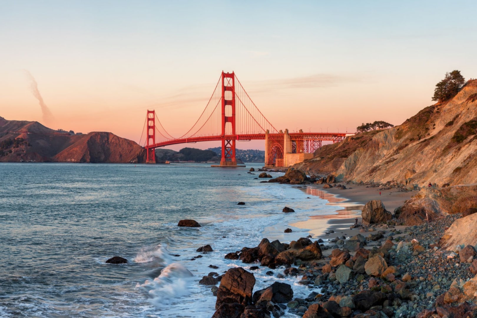
Golden Gate Bridge
An iconic symbol of San Francisco and California, offering stunning views and walking paths.
Architecture
1-2 hours
Free to walk, $8-10 for bike rental
Must-Try Local Dishes
Fish Tacos
Fresh fish, usually cod or mahi-mahi, served in a corn tortilla with various toppings.
Lunch/Dinner
Can be made gluten-free and vegetarian
In-N-Out Burger
A California classic, known for its fresh ingredients and secret menu.
Fast Food
Not vegetarian or vegan-friendly
Popular Activities
Hiking in Yosemite
Surfing in Malibu
Beach day in Santa Monica
Spa day in Napa Valley
Visiting museums in Los Angeles
Exploring historic missions
Kayaking in San Francisco Bay
Whale watching in Monterey
Best Time to Visit
Spring (March to May) and Fall (September to November)
These seasons offer pleasant weather and fewer crowds. It's ideal for outdoor activities and sightseeing.
15-25°C
59-77°F
Practical Information
Language
- Official: English
- Widely spoken: Spanish
- English: Widely spoken
Currency
US Dollar (USD)
Time Zone
PST (GMT-8) or PDT (GMT-7) during daylight saving time
Electricity
120VV, 60HzHz
Safety Information
Overall Safety Rating: Generally safe
California is generally safe for travelers, but it's important to stay aware of your surroundings, especially in crowded areas and tourist spots.
Important Precautions:
- • Keep valuables secure
- • Be cautious of your surroundings
- • Use reputable tour operators
Getting there
By air
- Los Angeles International Airport • 20 km from downtown Los Angeles
- San Francisco International Airport • 20 km from downtown San Francisco
By train
Los Angeles Union Station, San Francisco Transbay Terminal
By bus
Greyhound stations in major cities
Getting around
Public transport
Efficient and affordable, covering major attractions.
Taxis
Available • Apps: Uber, Lyft
Rentals
Car, Bike, Scooter
Neighborhoods
Hollywood
Mission District
Day trips
Santa Barbara
160 km (100 miles) from Los Angeles • Full day
Known for its beautiful beaches, Spanish colonial architecture, and wine country.
Muir Woods National Monument
24 km (15 miles) from San Francisco • Half day
Home to towering redwood trees and scenic hiking trails.
Festivals
Coachella Valley Music and Arts Festival • April
San Francisco Pride • June
Pro tips
- Visit national parks early in the morning to avoid crowds and secure parking
- Use ride-sharing apps for convenient and often cheaper transportation
- Explore local neighborhoods for unique dining and shopping experiences
- Check for any local events or festivals before planning your trip
- Stay hydrated and protect yourself from the sun, especially in coastal and desert areas
From $25
per person
Price varies by option
Secure booking
Free cancellation available
Instant confirmation


![[Private Group] 5-Day Tour to Tengchong Hot Spring Resort in Yunnan](https://res.klook.com/image/upload/activities/jjw2il8zdvseimw2s6pk.jpg)